Ausangate Trek Map | Breathtaking 6 Day Circuit with Rainbow Mountain

- Created: January 8, 2021 12:00 pm
- Updated: June 9, 2023 4:13 pm
- Distance Instructions
- Travel mode
- walking
- bicycling
- driving
- straight-line


- Distance 45 miles
- Time 144 h 0 min
- Speed 2 mph
- Min altitude 14150 ft
- Peak 16716 ft
- Climb 9911 ft
- Descent 10108 ft
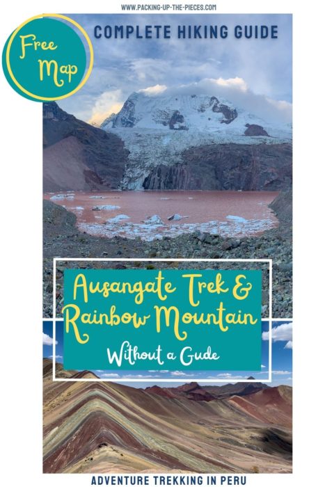
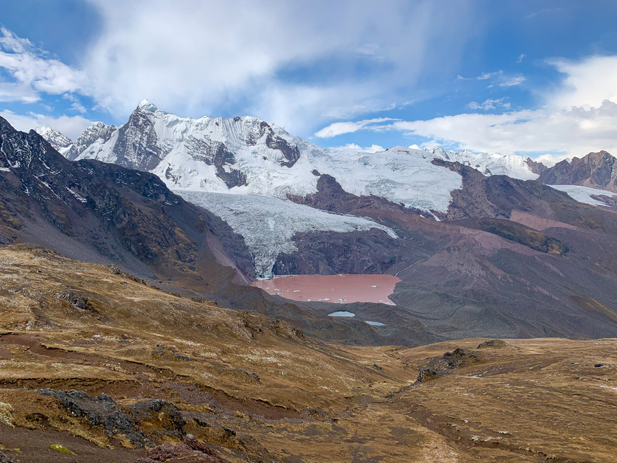
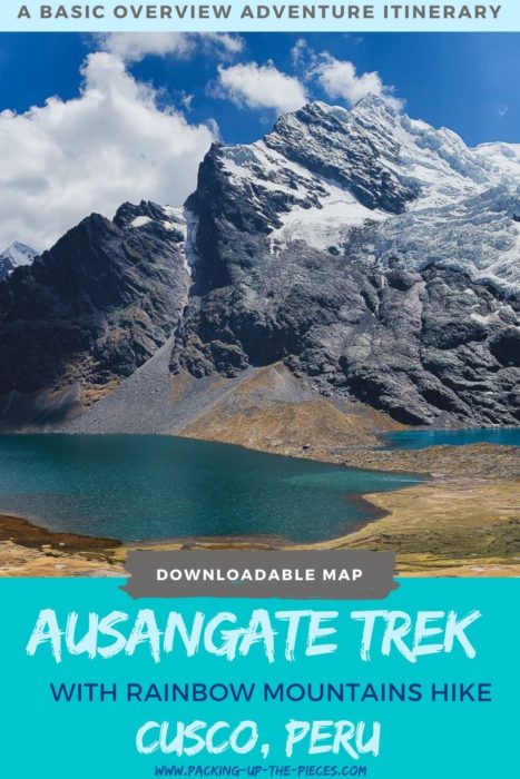
This is a basic overview of the 6 day Ausangate trek circuit with the option to add-on Rainbow Mountain and Red Valley. Included is a free downloadable Ausangate trek map.
This incredible multi-day trek is for adventure seekers looking to enjoy one of Peru's most scenic hikes. Walk among hundreds of alpacas and llamas. Maybe spot vicuñas and chinchillas along the way. Gaze upon diverse glacial peaked mountains and wander next to vivid blue alpine lakes.
The Ausangate trek is an epic trek and finds its way to the top of the list for the most beautiful treks in the entire world. This Ausangate trek map follows the main hiking circuit with an add-on to Rainbow Mountain and Red Valley.
⁉️ If downloading the map, please verify that the map is correct and follows the waypoints. Oftentimes, there are daily updates to the site, map platforms, and other external issues that may cause a bug in downloading. Be mindful that this map is solely for entertainment purposes. See my full disclosure here. Always hike responsibly and respect the mountains by following a no-trace philosophy, avoid hiking alone, be conscious of the weather and personal limitations, and do not stray from the visible trail
Ausangate Trek Map Logistics
- Loop Trail
- Add-On Out & Back Trail: Rainbow Mountain (Vinicunca) and the Red Valley (Valle Rojo)
- Mileage: Around 45 Miles, depending on route
- Difficulty: Challenging & Hard due to the altitude, remote trails, and little foot traffic
- Duration: 5 - 6 Days
- Trail Marker: There is some signage along the route. Many of the mountain passes have signs with the altitude. The path is pretty straightforward; however, if doing the hike independently download an off-line Ausangate trek map. Look for route arrows on rocks.
- Basic covered shelters can be found along the route and some have facilities like outhouses and running water.
- Ausangate Trek Gear Essentials
- Tent, I carry and love Nemo tents
- Durable high ankle hiking boots, Salomons are excellent and GORE-TEX is best
- Sleeping Bag for Cold Weather, I carried no less than a 15° Sleeping Bag, and a sleeping pad
- Trekking Poles
- Water Filter Kit
- Cooking Stove with enough fuel and cooking supplies for at least 5 days
- Portable Battery Packs for chargers (kept warm at night)
- Headlamp
- First-Aid Kit with at least one Emergency Blanket per person
- Layered clothing for all weather conditions, including warm gear for nights
- Coca leaves for altitude sickness and gifts
- Offline Ausangate trek map
- My Complete Peru Packing List for Multi-Day Treks
- This high-altitude trek never dips below 14,150 feet (4,000m)
- Due to the remoteness and altitude, it's best to hike in a group or with a local guide. Never hike alone.
- Find a hiking partner in the Cusco Hike Club
Schedule 6 Day Ausangate Trek & Map
- Day 1 | Upis - Wild Campsite | 8.5 miles
- Day 2 | Wild Campsite to Shelter near Laguna Ausangatecocha | 4.5 miles
- Day 3 | Shelter to Campsite before Rainbow Mountain | 6 miles
- Rainbow Mountain & Red Valley | Add minimum of 3 miles round-trip
- Day 4 | Campsite near Rainbow Mountain Campsite to Machuraccay Lodge | 8.75 miles
- Day 5 | Machuraccay Lodge to Campsite near Lakes | 10.5 miles
- Day 6 | Campsite via Pacchanta | 4 miles
Day 1 | Upis to Campsite Night 1
Depart Cusco early in the morning for the village of Tinki. In Cusco, catch the buses next to the stadium here.
From Tinki, take a taxi to Upis, or as far as the driver will take you. Most wont stop in the actual village of Upis, but rather on the road over 3 miles out. In Upis, soak in the hot springs or continue to the trailhead. Walk towards Abra Arapa Pass, and continue to a few lakes and streams that make a great place to camp.
Ausangate Trek Map | Day 1
- Distance: 8.5 miles
- Duration: 4 -6 hours
- Tips: A dip in the Upis hot springs is 5 PEN
Day 2 | Wild Campsite to Shelter near Laguna Ausangatecocha
Leave the stunning mirador and cross the river to take the scenic high trail. This trail has stunning views of the lakes and comes in above the two iconic lakes of Hatun Pucacocha. From here, continue on the path to Laguna Ausangatecocha to camp at the shelter. Sleeping at the shelter near Ausangatecocha allows ample time to explore this beautiful lake.
Note | To the right of Hatun Pucacocha there is a steeper trail that cuts in the direction to Rainbow Mountains via the Anantapata Lodge. This Ausangate trek map doesn't include that trail, but it can be found on maps.me
Ausangate Trek Map | Day 2
- Distance: 4.5 miles
- Duration: 3 - 5 hours
- Tips: There are covered shelters at the two mains lakes. For hikers who have less time, and more energy, take the alternative path for Rainbow Mountains.
Day 3 | Shelter to Camp Site Near Rainbow Mountain
Leave early in the morning for Rainbow Mountain.
Note | Some people choose to leave their gear behind at the shelter and do the trail as an out and back in 1 day; however, we didn't feel great about leaving our gear behind.
From the shelter, follow the trail on the hillside to the right of Surapampa. Continue on the trail past the village of Alcatarhui. Pass two small covered shelters and continue to wind towards the stunning Anantapata Lodge. From here, begin the uphill climb to Abra Warmisaya Pass.
Take the trail downhill past the section of dried out lakes. Head to the campsite. There is a water source is close by, but it is mucky and needs to be filtered. There are shelters here, but they are property of AB Expeditions. Contact them to inquire about the shelter use.
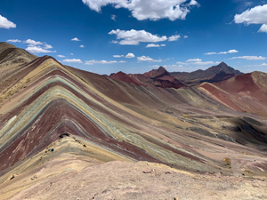
Behind the campsite is the short trail which leads to the viewpoint of Rainbow Mountain (Vinicunca).
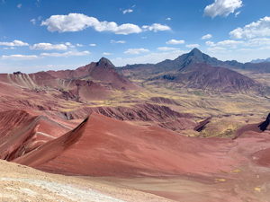
Red Valley (Valle Rojo) can be seen from Rainbow Mountain and is less than a 45 minute climb from the viewpoint of Rainbow Mountain.
Ausangate Trek Map | Day 3
- Total Distance: 9 miles (Includes Rainbow Mountain and Red Valley)
- Duration: 5 - 7 hours of hiking, but more time for exploring the sites
- Tips: The trail to rainbow mountain is short and takes around 30 minutes to walk. Don't miss Red Valley, which is overlooked, but just as special as Rainbow Mountain. Campers should watch the sunrise over Rainbow Mountain.
Day 4 | Camping Near Rainbow Mountain to Machuraccay Lodge
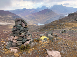
Leave early and follow the same route you took the day before, back to the shelter. Go through the Warmisaya Pass, walk past the Anantapata Lodge and back to the shelter near Laguna Ausangatecocha. The shelter is a great place to have lunch, stock up on water, and prepare for the uphill climb to Abra Paloman, the highest pass on this trek. Coming down the Abra Paloman Pass, look to the left for the "Red Lake." Here, find the high-end Machuraccay Lodge. It's possible to camp nearby.
Set-up camp and climb the rocks to get up close to the "Red Lake."
Ausangate Trek Map | Day 4
- Distance: 8.75 miles
- Duration: 6 - 8 hours
- Tips: Camp near the lodge to have access to fresh water. There are larger rocks which help protect the tent from the wind.
Day 5 | Machuraccay Lodge to Lakes Campsite
Leave early from the Machuraccay Lodge and follow the path along the river towards the village of Pampacancha.
The next section after Pampacancha is incredibly scenic and follows along a river. The trail continues along the left side of the river. Look for blue and white arrows that lead to the major pass of Abra Khampa. From Abra Khampa, the trail moves up and down in elevation until the downhill path finally begins.
After Khampa Pass, the trail will come to a fork. Follow the blue sign to the left for a few camping options. There are a few campsites on the left fork, but none to the right. Either trail is fine, but if camping, take the left trai.
From the lakes, Pacchanta village is about 4 miles away.
Ausangate Trek Map | Day 5
- Distance: 10.5 miles
- Duration: 7 - 9 hours
- Tips: There is a waterfall a bit off the main trail after Pampacancha. This is a great place to eat breakfast. On the way to Abra Khampa, follow the trail on the left side of the river. After Khampa, the lakes are part of the popular day trip of 7 Lagunas de Ausangate. There are lots of trails with epic viewpoints. The area near the 7 Lakes is well marked with signage.
Day 6 | Lakes Camsite to Pacchanta
Follow the lakes and continue on to Pacchanta. There are a few smaller and scenic lakes. The path is straightforward and continues into Pacchanta. Here, it's possible to soak in the hot springs for 5 PEN or eat at a restaurant. From Pacchanta, catch a car for Tinki. Cars cost 30 PEN and take around 30 minutes.
From Tinki, buses run back to Cusco frequently and should cost no more than 15 PEN.
Ausangate Trek Map | Day 6
- Distance: 4 miles
- Duration: under 2 hours
- Tips: Leave early to have plenty of time to soak in the Pacchanta Hot Springs. These Peru hot springs offer some of the best views in Peru. Buses run frequently back to Cusco, but can be delayed if not enough people are on the bus. Plan accordingly.
Ausangate Trek Map | 6 Day Circuit
Want all the logistics that accompany this Ausangate Trek Map? Get more detailed information of this Ausangate trek map, how to reach the trailhead, what to pack, useful tips and tricks, and how much the Ausangate trek costs without a tour. Follow along with this complementing blog post:
How to Hike the Epic Ausangate Trek Without a Guide
More Top Peru Multi-Day Treks
- Choquequirao Trek Visit the "Other Lost City" from Cusco
- Choquequirao to Machu Picchu Trek: Awesome Inca Trail Alternative
- Waqrapukara | The Most Epic Inca Site You've Never Heard Of
- 4 Day Colca Canyon Trek Without a Tour
- Best Cusco Treks & Cusco Trekking Safety Tips
Cusco & Sacred Valley Resources
- The Ultimate Cusco & Sacred Valley Itinerary in One Week
- Unique Cusco Itineraries & Best Cusco Multi-Day Treks
- 43 Epic Things to Do in Cusco
- Where to Eat in Cusco with over 40+ Recommendations!
- Cusco South Valley Tipon, Pikillaqta, & Andahuaylillas
- The Complete Guide to the Sacred Valley Peru
- The Best Things to Do in Urubamba Peru
- The Ultimate Guide to Ollantaytambo Peru
- 35 Inca Ruins in Peru You Need to Visit
- 32 Unique & Famous Peru Landmarks
- 22 Charming Villages in the Andes Mountains



1. Taxi Drop-off
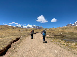
Taxi from Tinki will drop-off before the small village of Upis | Cost: 30 PEN | 30 minute taxi ride
2. Upis Trailhead

Begin the trailhead past the tiny village of Upis | Lodging, Camping, & Hot Springs here
3. Abra Arapa | Pass
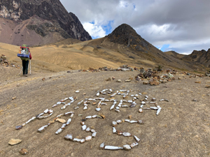
4. Camp Night 1 | Wild Camp
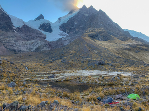
Mirador & wild camping | garbage can
5. River Crossing
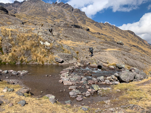
Cross the river to stay on the official trail
6. Iconic Lakes | Covered Shelters
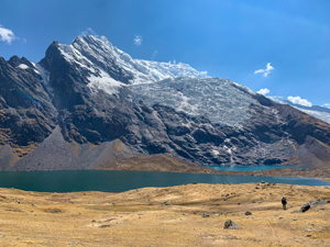
Free covered shelters & iconic lakes of the Ausangate Trek | Hatun Pucacocha
7. Sleep Night 2 | Shelter with Basic Facilities
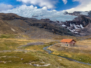
Covered Shelter | Basic Facilities, running water, outhouse, garbage
8. Anantapata Lodge | Camping Facilities Nearby
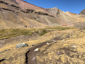
High-end Lodge with Camping Facilities nearby
9. Abra Warmisaya | Pass
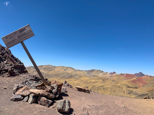
10. Sleep Night 3
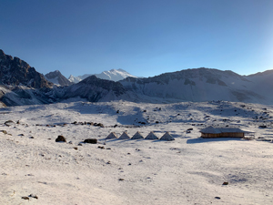
UPDATE 2023: These shelter huts are property of AB Expeditions Tour Group
11. Rainbow Mountain
12. Red Valley
13. Abra Paloman | Pass
14. Sleep Night 4 | Machuraccay Lodge | Camping Space
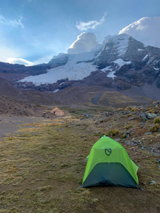
High-end Lodge near Red Lake | Wild camping nearby with fresh water source
15. Shelter with Basic Facilities

Basic Shelter with running water
16. Abra Khampa | Pass

17. Viewpoint
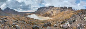
Covered viewpoint with garbage
18. Camp Night 5 | Basic Facilities
Covered Shelter with outhouse
19. Pacchanta
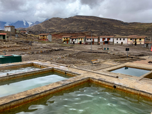
Village with Basic Hot springs | Cost: 5 PEN | Restaurants with Menu | Cars back to Tinki | Cost: 30 PEN