Unique Colca Canyon Trek Map | 4 Days
- Created: April 28, 2022 1:00 pm
- Updated: July 14, 2023 3:58 pm
- Distance Instructions
- Travel mode
- walking
- bicycling
- driving
- straight-line


- Distance 18 miles
- Time 96 h 0 min
- Speed 2 mph
- Min altitude 6946 ft
- Peak 11194 ft
- Climb 6936 ft
- Descent 11076 ft

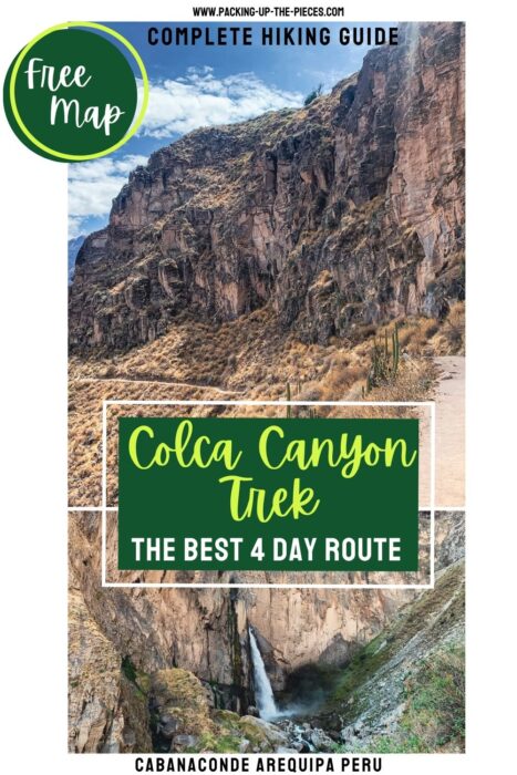
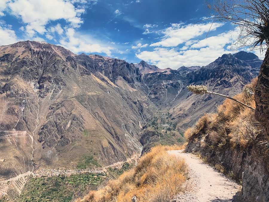
This is a basic overview of just one of the many diverse routes for hiking Colca Canyon without a guide, famed for being the second deepest canyon in the World. This Colca Canyon trek map follows a 4-day route from the Mirador San Miguel trailhead to the small village of Llahuar.
There are multiple Colca Canyon hiking routes, to choose simply decide how much time you have and what points of interest stand out for you. While most standard Colca Canyon trek tours are two days and one night, this independent hiking Colca Canyon guide travels a little deeper into the Canyon (pun totally intended). This self-guided Colca Canyon trek is for those looking to experience Cañón del Colca at their own pace.
Standard Colca Canyon Tour Route | 2 Days & 1 Night | San Miguel ➜ San Juan de Chuccho ➜ Oasis Sangalle ➜ Cabanaconde
This Colca Canyon Trek Map | 4 Days & 3 Nights, but no hiking on Day 4 | San Miguel ➜ San Juan de Chuccho ➜ Oasis Sangalle ➜ Fure & Huaruro Waterfall ➜ Llahuar ➜ Bus to Cabanaconde
Highlights along the way include incredible views along the path including the "Oasis" village of Sangalle, Huaruro Waterfall, and the hot springs in Llahuar.
This basic Colca Canyon map and overview hiking guide includes how to reach the trailhead from Arequipa, helpful tips, basic Colca Canyon packing list, and places to sleep in the Colca Canyon.
Here's a 4 day Colca Canyon Map and trekking route from Mirador San Miguel to Llahuar.
⁉️ If downloading the map, please verify that the map is correct and follows the waypoints. Oftentimes, there are daily updates to the site, map platforms, and other external issues that may cause a bug in downloading. Be mindful that this map is solely for entertainment purposes. See my full disclosure here. Always hike responsibly and respect the mountains by following a no-trace philosophy, avoid hiking alone, be conscious of the weather and personal limitations, and do not stray from the visible trail
Colca Canyon Trek Map 4 Days
☛ Colca Canyon Hiking Tip | Those hiking Colca Canyon without a guide will want to lighten their load and leave behind non-essential items in Arequipa. Way Kap Hostel Arequipa stores excess bags and gear at no extra cost. They also offer a safe for laptops and valuables.
It's best to hike with a group or buddy if hiking Colca Canyon without a guide or tour. Sadly, many hikers have gone missing in the Colca Canyon Peru.
- Point-to-Point Trail
- 4 Day Itinerary
- This Colca Canyon trek map starts from Mirador San Miguel and ends in Llahuar village
- Mileage: +/- 18 miles | Be mindful the many Colca Canyon routes can alter this
- Difficulty:Moderately Difficult - Hard depending on the route, how many days, ect
- Most routes include up and down ascents and descents on narrow and steep trails.
- Trail Markers: The trail is fairly well marked with large signboards with arrows along the route. Sometimes the smaller paths aren't marked, so an offline Colca Canyon trek map is essential. Maps.me has all of the trail options
- Camp or Stay in Guest Houses in the Colca Canyon
- There are guesthouses in each village that provide shelter and add-ons like dinner, breakfast, and beverages.
- It's also possible to camp in the Colca Canyon for much cheaper at the guest houses and even some wild campsites along the route.
- Average cost for a bed (no meals) is 25 PEN ($6.50 USD) per night
- Average nightly camping fee is 8 PEN ($2)
- Packing List & Gear Essentials for Multi-Day Colca Canyon Trek
- Tent, Sleeping Bag, Sleeping Pad (Optional)
- Stove, cooking gear, food and snacks (Optional, but guests have no access to the kitchens)
- Hiking Books with good ankle support, even better if they are water resistant
- Layered clothing, preferably long sleeves and pants for sun protection and from brushy overgrowth
- Baseball cap, sunscreen
- Small toiletries & quick-dry towel
- Swimsuit
- Lightweight Rain Jacket
- Dry, warm clothing for night
- Plenty of Water & Water Filter or water purification tablets
- First-Aid Kit
- Offline Colca Canyon Trek Map
- Hiking Poles if you love them
- Chargers, cords, cables, battery pack, headlamp (Many places shut off electricity access at night)
- Small bills for guesthouses, Colca Canyon entrance fee, snacks, and food along the route
- Here's my Complete Peru Packing List for Multi-day Treks
How to Get to Colca Canyon from Arequipa
Most hikers will depart early from Peru's "white city of Arequipa." If following this Colca Canyon trek map, try to catch the 3 a.m. bus from the Arequipa Bus Terminal. When you purchase the ticket, say you wish to exit at Mirador San Miguel. Remind the driver and also follow along on an offline map.
🚌 Arequipa to Cabanaconde Bus Logistics | Buses depart from: Arequipa Terminal Terrestre | Bus Company: multiple, I went with Milagros | Standard Ticket Price: 18 PEN ($4.75) / pay the exit tax 1.50 PEN before departure | Duration: +/- 6 hours
There are also collectivos that depart from a stand near the Terminal. With the vans, there is no set departure time. They depart when full. The shared vans may only drop as far as the gateway village of Chivay, where you will transfer deeper into the canyon. Find the vans here or check in with Caminos del Inca.
There's also this private shuttle that picks you up from your hotel in Arequipa, stops at the Cruz del Condor, and drops in Cabanaconde at 9:30 a.m (70 PEN / $18.50 USD).
Schedule | Colca Canyon Without a Guide | 4 Days
- Day 1 | Mirador San Miguel to Oasis Sangalle | 9 miles
- Day 2 | Oasis Sangalle to Fure | 6.25 miles | Add-On Trek to Waterfall (2 miles each way)
- Day 3 | Fure to Llahuar | 3.5 miles
- Day 4 | Collectivo to Cabanaconde | Add-On Full Day hike for extreme uphill trek to Cabanaconde
Colca Canyon Entrance Fee: $70 PEN ( $18.50 USD) and valid for 5 days. Pay it upon entrance, usually someone waiting at the trailhead or the popular Cruz del Sur Viewpoint
Day 1 | San Miguel Viewpoint to Sangalle "Oasis"
Exit the bus at Mirador San Miguel. Here, pay the entrance fee and begin the downhill trek to the San Juan bridge. From there, you'll trek uphill either to or above the village of San Juan Chuccho. Be mindful that hiking the Colca Canyon is a lot of ups and down, both steep and gradual ascents and descents.
Take a break and then begin the uphill climb to the small hamlets of Cosñinhua and Malata. There are some nice viewpoints with covered benches as you begin the ascent into the most popular stop on the Colca Canyon hike, Sangalle Oasis.
☛ Travel Tip | There is a man near the main intersection and signboard for Fure, Sangalle, and Malata before the trek down into Sangalle. He sells water and snacks for half the price compared to Sangalle. I highly suggest stocking up on supplies from him.
Colca Canyon Trek Map Day 1
- Distance: 9 miles
- Duration: +/- 7 hours, dependent on weather, breaks, and fitness level
- Sangalle Elevation: 7,395 ft (2,254 m)
- Popular Sangalle Guesthouses:
- Oasis Paraiso Ecolodge | Mountain lodge with pools, camping available
- Paraiso Las Palmeras Lodge | Mountain lodge with pool, camping available
Day 2 | Sangalle to Fure
Depart early from Oasis Sangalle. Start with an uphill trek to Apacheta Viewpoint. There is the main trail farther up, but there is also a "goat trail" marked on this Colca Canyon trek map that can shave off some time. Use your judgement.
After savoring the views from Apacheta, continue towards Fure village. It's best to follow the road, as there is private property. The trail narrows out. Be mindful, there are some sections of the path in rough shape from rockslides and erosion. It's a steeper ascent to the tiny village of Fure, which is literally built on the hillside.
The main draw here is to hike to the Fure Waterfall (Catarata Huaruro). The scenic 2 mile trail (each way) has a slight and steady incline, but is totally worth it! Take a picnic and enjoy this place with barely any tourists.
Colca Canyon Trek Map Day 2
- Distance: 6.25 miles +4 for Fure Waterfall (10+ miles)
- Duration: +/- 6 hours to Fure +/- 2 hours for Waterfall
- Fure Elevation: 10,210 ft (3,112 m)
- Fure Guesthouses:
- Fure Wasi Camping
Day 3 | Fure to Llahuar
Leave Fure in direction of Llatica. This scenic downhill trail section is nice. Cross the Molloco River via the bridge and continue with a small to the Llatica Church. This is an ideal place to break.
The terrain is up and down, until a final descent into Llahuar.
Colca Canyon Trek Map Day 3
- Distance: 3.5 miles
- Duration: +/- 2.5 hours
- Llahuar Elevation: 6,910 ft. (2,106 m)
- Popular Llahuar Guest Houses:
- Casa de Virginia | Mountain lodge with hot spring pools, garden, camping available
- Llahuar Lodge | Mountain lodges with hot springs on the Colca River
Day 4 | Llahuar to Cabanaconde
On Day 4, simply walk 20 minutes to the bus station that is marked on this Colca Canyon Trek map.
🚌 Llahuar to Cabanaconde Bus | Average Fare: 10 -15 PEN ($2.65 - $4) | Duration: 1.5 hours | Current Departure Schedule: 5:00, 11:00, but buses are never on time
There are often two daily collectivos. Check in with your guesthouse, but times are usually early morning and before noon. The buses are coming from deeper from the canyon, so these times are simply estimates.
Oftentimes, there is usually a man with his truck offering groups a ride (as the buses are usually full). This guy is a genius and charges for it. :)
🚌 Private Truck | Average Fare: 180 PEN ($48) and fits up to 6 people | Duration: 1.5 hours
However, if you want to hike from Llahuar to Cabanaconde it's possible. This is a mostly uphill and steep route that passes through Chuirca, Achachihua Viewpoint, and arrives into Cabanaconde.
🥾 This would be an extreme hike of almost 6.75 miles with a grueling ascent of almost 4,000 ft
Return to Arequipa or More Adventures in the Colca Canyon
Once in Cabanaconde, catch a bus back to Arequipa. There are a few departures daily, but 14:00 is the last bus to Arequipa!
🚌 Cabanaconde to Arequipa Bus | Buses depart from the Cabanaconde Plaze del Armas | Average Bus Fare: 16 PEN ($4.25 USD) | Duration: 6+ hours | Current Departure Schedule: 9:00, 11:00, 14:00
✔ More Arequipa Travel Resources | Where to Eat in Arequipa | 3 Districts to Visit in Arequipa | 10 Typical Dishes in Arequipa You Have to Try
Top Things to Do in the Colca Canyon
If you want to adventure more in the Colca Canyon Peru, hop off in Yanque. This charming village in South America is only 1 hour and 30 minutes from Cabanaconde and offers tons of adventures.
- Yanque Peru Travel Guide
- Soak in the Yanque Hot Springs
- Best Alternative Colca Canyon Day Hike to Coporaque Village and Uyo-Uyo Ruins
4 Day Colca Canyon Trek Map & More
Want all the logistics that accompany this 4 Day Colca Canyon Trek Map? Get more detailed information, useful tips and tricks, photo inspiration, and how much this popular Peru multi-day costs. Follow along with this complementing blog post:
The Ultimate Trekking Colca Canyon Guide
More Top Peru Multi-Day Treks
- Ausangate Trek with Rainbow Mountain & Red Valley
- Choquequirao Trek to the "Other Lost City"
- Waqrapukara Ruins the Most Epic Inca Ruins in Peru
- Choquequirao to Machu Picchu Trek The Best Alternative Inca Trail
- Unique Cusco Itineraries & Best Cusco Multi-Day Treks
1. Mirador San Miguel Trailhead Colca Canyon

Official San Miguel Trailhead | Entrance Fee Point | Garbage Drop
2. San Juan Bridge
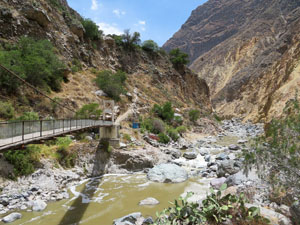
3. Upper San Juann de Chuccho Route
Alternative Trail Option
4. Makeshift Tienda & Trail Markers
Man selling water half the price than in Oasis | Trail to Fure
5. Oasis Paraiso Ecolodge
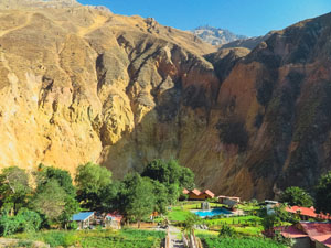
8 PEN to Camp | Vegetarian Dinner 15 PEN
6. Mirador Apacheta

Covered Lookout point with Bench
7. Viewpoint

Covered Viewpoint on the trail to Fure
8. Fure Wasi Camping
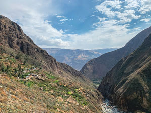
Camping 10 PEN
9. Huaruro Waterfall
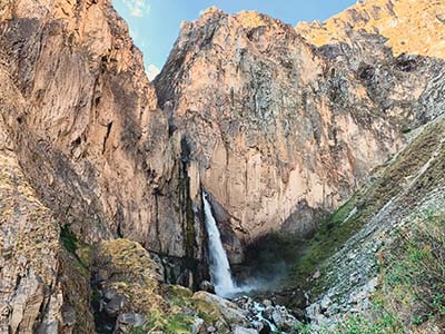
Catarata de Fure | 1 Hour to Reach Waterfall from Fure along an extremely Scenic Path | Maps.me Coordinates: -15.53433, -71.998611
10. Fure to Llatica
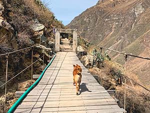
Bridge out of town to LLatica
11. Llatica Church
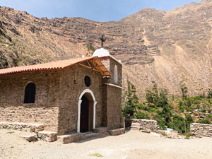
Follow Trail closest to Molloco River
12. Casa de Virginia
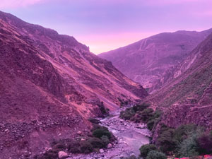
Guesthouse with hot springs | Camping 5 PEN
13. Bus Stop to Cabanaconde
2 Daily Buses to Cabanaconde