Visit the Fascinating Site of Choquequilla (Ñaupa Iglesia)

- Created: March 27, 2020 1:00 pm
- Updated: June 9, 2023 4:05 pm
- Distance Instructions
- Travel mode
- walking
- bicycling
- driving
- straight-line


- Distance 3 miles
- Time 1 h 14 min
- Speed 2 mph
- Min altitude 9242 ft
- Peak 9856 ft
- Climb 1227 ft
- Descent 1214 ft
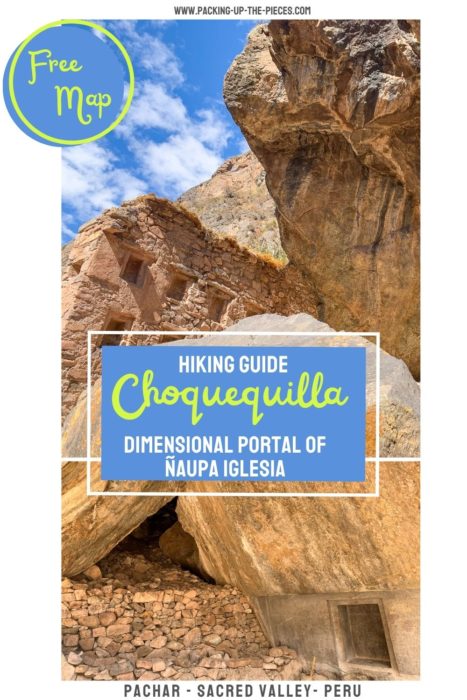
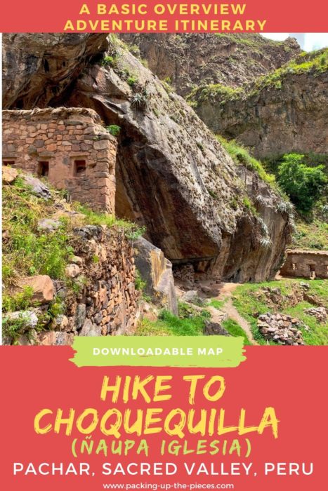
This is a map and basic overview on how to hike to the peculiar site of Choquequilla. This special and unusual ruin site is more commonly known as Ñaupa Iglesia. This is a free Inca ruin in the Sacred Valley of Peru that requires no entrance ticket. Go simply to experience the magic of this place.
Some say the ruins of Choquequilla predate the mighty Inca empire and contain a dimensional portal to another world. Others say it's a wormhole to Egypt. Either way, Choquequilla makes an epic and worthwhile detour and day hike while visiting Peru's Sacred Valley.
It's easy to reach this site via a mostly flat walk from the tiny hamlet of Pachar, which is a quick collectivo ride from Ollantaytambo. Alternatively, it's possible to walk from Ollantaytambo, past the Choqana ruins near and continue to the Choquequilla ruins.
Here's a basic overview on how to reach the Choquequilla Archaeological Site without a tour and other add-on hikes from this site.
⁉️ If downloading the map, please verify that the map is correct and follows the waypoints. Oftentimes, there are daily updates to the site, map platforms, and other external issues that may cause a bug in downloading. Be mindful that this map is solely for entertainment purposes. See my full disclosure here. Always hike responsibly and respect the mountains by following a no-trace philosophy, avoid hiking alone, be conscious of the weather and personal limitations, and do not stray from the visible trail.
Choquequilla Hike from Pachar
- Out & Back Trail
- Trailhead starts from Pachar Village
- Look for add-on hikes below
- Choquequilla Hike Difficulty: Easy & Flat
- One-Way Distance: a little over 1.5 miles
- Time: Plan on 2-3 hours depending on how long you choose to explore the Choquequilla ruins
Basic Overview of How to Hike to Choquequilla
Take a collectivo to Pachar from either Ollantaytambo or Urubamba Peru. Pass the Cerveceria del Valle Sagrado for now, but this popular microbrewery has small plates of food and a lovely outdoor garden with scenic overlooks of the Urubamba River. It makes a nice stop after visiting Choquequilla.
Cross the orange bridge and turn right to continue to the tiny hamlet of Pachar. Walk on the main road until you see a reddish bridge. As soon as you cross the bridge, turn left and join onto the railroad tracks. Be mindful, these train tracks are still used frequently. It is possible to walk on the main road, but it isn't nearly as scenic and the road is shared with cars rushing by.
After a bit, the path will meet up again with the road. Cross the road and continue along the railroad track. Keep your eyes peeled for a blue and white sign that marks the entrance for Choquequilla. This sign is smaller than the typical red and white Archaeological Park signs. Follow along on the foot path, until on the right the first views of the large cave will come into site. Climb up the stairs to enter Choquequilla.
Entering Choquequilla really does feel like stepping into another dimension. The cave has a few interesting ruins that are crumbling near the entrance, but the real highlights are the peculiar alter that boasts intricate carvings and the "portal." The stone color also doesn't seem to match the surrounding mountains.
Look on the side of the cave and notice the large square carved into the side of the cave. Notice how there are two layers? This is said to be the "dimensional portal" that has ties to Egypt.
Show respect by bringing coca leaves as offerings to Pachamama (Mother Earth) and the Apus (Mountains)
Interested in Hiking to Choquequilla?
Want to know about how to independently hike to Choquequilla? Find useful information, how to reach the trailhead, tips and tricks, alternative routes, and how much it costs to reach this ancient sacred site. Also find out more about the epic and worthwhile itinerary add-ons in this complementing blog post:
The Complete Guide on how to Visit Ñaupa Iglesia in the Sacred Valley
Add-On Sacred Valley Hikes from Ñaupa Iglesia
Pachar has many great hiking options, so there are a few hikes that can be added on. These hikes range from simple to advanced multi-day treks from Choquequilla.
Easy | Hike to or from Pachar to Ollantaytambo
Follow an Old Inca Trail that connects Pachar to Ollantaytambo village. This short and flat path follows the river and passes by Inca terraces and the Choqana ruins. It is part of the Qhapaq Ñan ancient Inca trail system.

- More Qhaqpaq Ñan Trails
Mid-Range | Perolniyoc Waterfall & Raqaypata Ruins
Continue past Choquequilla and reach the small town of Soqma. From there, continue to the Perolniyoc Cascade. Follow the steep up-hill trail to another free Inca site, the Raqaypata Archaeological Site. These impressive ruins sit on top of the waterfall.

Advanced | Laguna Ancascocha
After the Perolniyoc Waterfall, there is a 2 day trek option to reach Laguna Ancascocha. This is a truly off-the-beaten-path trek in Peru. There are no villages along the route, so this advanced trekking route is only for those hikers who feel comfortable in their abilities and navigation skills.
Return to Pachar via the same path, or before the descent into the tiny hamlet of Rayon, opt for the detour to Inti Punku Ollantaytambo. On the way down to Ollantaytambo, follow the Old Inca Quarry Trail.
More Sacred Valley Resources & Hikes
- The Best Cusco and Sacred Valley Itinerary in One Week
- The Ultimate Guide to the Sacred Valley Peru
- The Best Things to Do in Urubamba Peru
- Pumamarca Ruins from Ollantaytambo
- Hike the Magical Saywa Mountains in Urubamba
- Laguna Juchuycocha a Hidden Alpine Lake the Sacred Valley
- Hike from the Maras Salt Mines to the Moray Inca Ruins
- How to Visit the Maras Salt Pond without a Tour
- Huchuy Qosqo Trek to "Little Cusco"
- Kinsa Cocha Pisac
- 22 Charming South America Villages in the Andes Mountains
Cusco Travel Guides
- 23 Spectacular Things to Do in Cusco
- Find the Best Things to Do on a Cusco Itinerary
- 40+ Recommendations on Where to Eat in Cusco
- Maukallaqta & Puma Orqo from Cusco
- 35+ Inca Sites to Discover in Peru
- 32 Landmarks in Peru | Unique & Famous Places to Visit
- Choquequirao Trek to the "Other Lost Inca City"
- Waqrapukara Ruins the Best Inca Site in Peru
- Choquequirao to Machu Picchu Trek Without a Guide
- Ausangate Trek with Rainbow Mountain & Red Valley

1. Begin trailhead to Choquequilla
Walk past the Cerveceria del Valle Sagrado. Cross the orange bridge and take a right.
2. Railroad Tracks
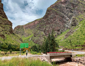
Turn left after the red bridge to follow along the railroad tracks
3. Footpath to Choquequilla
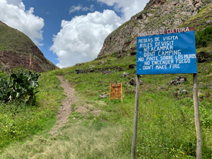
Meet the road and cross the street to begin the footpath to Choquequilla
4. Choquequilla (Ñaupa Iglesia) Archaeological Site
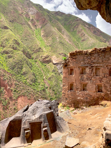
The sacred site of Choquequilla