
Picos de Europa Day Hike Poncebos – Bulnes – Sotres – Tielve | Complete Full Day Hike Map

- Created: January 29, 2023 1:00 pm
- Updated: June 9, 2023 4:24 pm
- Distance Instructions
- Travel mode
- walking
- bicycling
- driving
- straight-line


- Distance 15 miles
- Time 9 h 30 min
- Speed 2 mph
- Min altitude 735 ft
- Peak 3999 ft
- Climb 5427 ft
- Descent 5561 ft
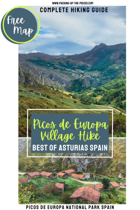

This is a basic map and overview of the full-day hike from Poncebos to some of the best Asturias villages in the Picos de Europa National Park. This circuit hike starts from Poncebos, passes through Bulnes pueblo, continues into Sotres, and on to Tielve. While it's possible to walk from Tielve to Poncebos, the path is on the main road, so taking the bus is a nice option.
Here's a Picos de Europa hiking guide for the Poncebos full circuit hike.
⁉️ If downloading the map, please verify that the map is correct and follows the waypoints. Oftentimes, there are daily updates to the site, map platforms, and other external issues that may cause a bug in downloading. Be mindful that this map is solely for entertainment purposes. See my full disclosure here. Always hike responsibly and respect the mountains by following a no-trace philosophy, avoid hiking alone, be conscious of the weather and personal limitations, and do not stray from the visible trail
Picos de Europa Day Hike Logistics for Poncebos Loop Trail
- Loop Trail
- Official Trail Name: The route follows the GR-202 La Ruta de Reconquista until Invernales del Texu, where it continues on the road to Sotres. From Sotres, follow the PR-PNPE 20 Monte Camba to Tielve
- Trail Markers are Red and White Rectangles (Blazes), Monte Camba is Yellow and White Blazes
- Difficulty: Moderate- Challening, due to the distance and time
- Some stretches of the trail have steep ascent and sometimes narrow pathways
- Those who are fearful of heights may not feel comfortable hiking to Bulnes Asturias or from Sotres to Tielve
- The trail can be stoney and can be slippery and muddy in the rain
- Total Distance Poncebos to Poncebos: Around 15 miles (24.3 Km)
- Recommended Route: Poncebos to Tielve: 11.5 miles (18.5 Km)
- Excursion Duration: 8-10 hours, dependent on weather, stops, speed, ect
- This Picos de Europa hiking route is best to hike in the peak and shoulder season before the snow falls. In the summer, start in the morning to avoid walking in the intense sun and make sure to allot enough time walk in the daylight.
- Essentials for Day Hiking in the Picos de Europa
- First-Aid Kit
- Small Day Hiking Backpack
- Water in a Reusable Water Bottle
- Trekking Poles if you love them
- Hiking Boots or trail runners
- Layered clothing and hiking pants for some of the overgrown parts of the trail
- Snacks & Food
- Euros for cafes and restaurants
How to Get to Poncebos Asturias
This Picos de Europa trek is accessible from Poncebos and during the summer and shoulder season can be reached by public bus from the village of Las Arenas de Cabrales.
🚐 Las Arenas de Cabrales to Poncebos | Bus Company: Alsa | Duration: 10 minutes | Bus Ticket Price: €1.55 | Bus Times: Buses depart Las Arenas on the hour from 8:00-13:00 & 17:00-19:00 / Buses run from June to mid October | Check the Alsa Bus Schedule Here
Verified taxis run between Las Arenas de Cabrales and Poncebos and cost around €8 - €10.
If visiting Picos de Europa National Park with a car, there are parking options along the road near Poncebos. Be mindful that parking can be hard to snag, especially during the busy summer season and on weekends.
🥾 Picos de Europa Hiking Guide | The Best 8 Hikes from Poncebos Asturias
How to Reach The Asturias Village Hike Trailhead
Buses drop visitors at the Bulnes Funicular parking lot. If the weather is bad or you don't feel like hiking, it's possible to ride the Bulnes funicular.
Bulnes Picos de Europa is only accessible by foot or via the funicular. There is no car road to Bulnes.
Poncebos to Bulnes Funicular | Company: Alsa | Duration: 7 minutes | Round-Trip Ticket Price: €22.16 | Departure: every 30 minutes from Poncebos | Hours: High Season: 10:00-13:00 & 14:00-20:00 / Low Season: 10:00-12:30 & 14:00-18:00
From the Bulnes funicular parking lot, walk towards the Hotel Garganta del Cares and head to the the Bulnes trailhead. This walk is 15-20 minutes along the road, and although the road is not especially busy with traffic, stick to the left side of the road.
Poncebos to Bulnes
Follow the trailhead to Bulnes. This route is officially called "Canal del Texu" and is clearly marked with an information signboard. The signboard also marks the famous Ruta del Cares that runs parallel along the Rio Cares.
The Cares Gorge hike is the most popular day hike in the Picos de Europa National Park.
The trail is apparent and continues uphill past where the funicular drops and into scenic Bulnes village.
🥾 Poncebos to Bulnes de Abajo | Distance: 2.5 Miles (4 Km) | Duration: 1 - 1.5 hours
☛ Here's the complete hiking guide for Bulnes Asturias
Mirador del Bulnes
To continue on to Sotres, leave the village towards the Mirador del Bulnes, or Mirador Picu Urriellu On a clear day, take the short detour to the viewpoint to see one of the most iconic limestone peaks in the Picos de Europa National Park, Naranjo de Bulnes.
The trail to Sotres follows the rocky path through a forest. There is a small stream to ford. Eventually, the path opens up to incredible views of the mountains and distant views of small stoney shepherd huts that are notorious in this area. There are trail markers along the way.
Fuente la Jelguera
The Fuente la Jelguera is a small hut that has an overflowing water fountain. On a hot sunny day, this is a great place to fill up water and take a quick rest. There's a wooden signboard. To reach Sotres, head in the direction to Pandebano Pass.
The hiking path continues through the exposed mountains, directly past stone houses and opens up to the fabulous Pandebano Pass.
Pandébano Pass
The Pandebano Pass offers spectacular views of Naranjo de Bulnes to the right. There is a signboard that points in the direct of Sotres.
Follow the trail down to the gravel road. Stay on the gravel road, but look for the red and white blazes, they twist through a small wooded section to open up to panoramic views of Invernales del Texu.
Eventually take the dirt road to Invernales del Texu.
🥾 Bulnes to Pandebano | Distance: 2.3 Miles (3.7 Km) | Duration: 1.5 hours
Invernales del Texu
Invernales del Texu are stone winter huts that shepherds utilize for their livestocks. The stone buildings are mostly abandoned, but make for an interesting and beautiful stroll.
After passing through the village, instead of continuing further on the Ruta de la Reconquista, head uphill via the road to the village of Sotres.
Sotres Village
Sotres is the highest village in the Picos de Europa at 3,445 feet (1,050m). The village is small but offers a great stopping point to sip on a local Asturian cider or beverage. There are a handful of restaurants, cafes, and a few tiendas selling the famous Cabrales cheese.
There's a water fountain in the center of town and a bus stop if you feel like returning to Poncebos from here.
There are two routes to Tielve from Sotres, but to complete this trek in a day, take the shortere PR-PNPE 20 Monte Camba route. The trailhead is marked on this map on the far side of town and continues for about on hour down the mountain to meet the road right before Tielve.
🥾 Pandebano Pass to Sotres | Distance: 3.4 Miles (5.5 Km) | Duration: 2 hours
Tielve Village
Tielve is a super tranquil village in the Picos de Europa that is overlooked. Wander the cute streets, or grab a drink in one of the cafes.
From Tielve, there are two path options, but the hiking path is not recommended. There are reports of rockslides and some sections of the trail being dodgy. The locals recommend to follow the road to Poncebos.
🥾 Sotres to Tielve via Sotres | Distance: 3.3 Miles (5.3 Km) | Duration: 1 hour
Return to Poncebos
Although the road is not busy, it's best to catch the bus from Tielve to Poncebos. Otherwise, the last 5 km is entirely on the road. Budget at least an hour to walk the 3 miles on the road to Poncebos.
The route ends in Poncebos at the Bulnes Funicular Parking Lot.
☛ Hostal Poncebos is an awesome place to stay in Poncebos. Here, find a welcoming family, delicious and hearty meals, and a rustic charm that is steps away from some of the best hikes in the Picos de Europa. Alternatively, there are tons of places to stay in nearby Las Arenas de Cabrales.
Picos de Europa Day Hike to the Best Asturias Villages
This is a map and basic overview of the Poncebos circuit hike in the Picos de Europa National Park Spain. For the complete hiking guide, detailed directions, photo inspiration, bus schedules and more, read the complementing blog post:
Hike the best Asturias Villages in the Picos de Europa | Poncebos Circuit Hike
More Picos de Europa Guides
- Picos de Europa National Park in 4 Days
- Cares Gorge Hike the Best Hike in the Picos de Europa
- Best things to do in Las Arenas de Cabrales Asturias
- 8 Best Picos de Europa Hiking Trails from Poncebos Asturias
- How to Hike to Bulnes and What to Do There
- Awesome Ruta Rio Casaño Day Hike at the Foothills of the Picos de Europa

1. Trailhead to Bulnes

Trailhead to Bulnes Ruta La Canal del Texu
2. Bulnes de Abajo
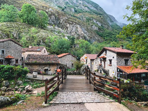
Lower Bulnes
3. Mirador Picu Urriellu (Mirador de Bulnes)

The trail continue past the mirador, optional stop
4. Wooden Signboard | Fuente la Jelguera

Signboard with small shelter and water fountain
5. Signboard | Pandébano Pass

Signboard with option to continue to Sotres or Refugio Vega de Urriellu
6. Invernales del Texu
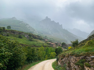
huts that shepherds utilize in the winter months
7. Sotres
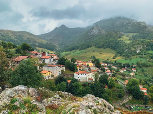
The highest village in the Picos de Europa
8. Short Trailhead to Tielve

9. Tielve Bus Station

Entrance to Tielve Village and where to catch the bus to Poncebos
10. Bulnes Funicular Parking Poncebos
The bus drops at the Bulnes Funicular Parking lot in Poncebos