

8 Best Picos de Europa Hiking Routes from Poncebos Asturias & How to Visit
The Picos de Europa National Park in northern Spain is no longer one of the country’s best-kept secrets. This sprawling 250 square-mile National Park in Spain stretches across three very diverse autonomous communities of Cantabria, Asturias, and León (Castilla & León).
The Picos de Europa is one of Spain’s most beautiful National Parks with charming villages, alpine lakes, unique limestone peaks, mountain huts, delicious cuisine, and of course, endless hiking trails.
The tiny village of Poncebos may be one of the best places in the Picos de Europa to base for hikers. The village is a gateway to explore the vast and scenic hiking paths and mountain hamlets of the Picos de Europa.
Poncebos Asturias is small. The village consists of only three accommodation options, each with a full-service restaurant with a bar to replenish and refuel tired hikers. There is also the famous hydroelectric power station and limited parking places for the Cares Gorge hiking trail.
This Picos de Europa hiking guide for Poncebos includes 8 different Picos de Europa hiking trails, useful tips for sleeping in Poncebos, and how to get around the Asturian region of the Picos de Europa National Park without a car.
Here’s how to make the most of your time hiking in the Picos de Europa from Poncebos in Asturias.
Table of Contents
Disclosure: This is part of my Hikes & Adventures series, which means these treks can be strenuous and challenging. These are my experiences and I am not an expert. Please have all the proper equipment, verify the weather conditions, use professional resources, do your own research, be mindful of constantly changing trail conditions, and take into consideration your own physical abilities and/or limitations. These guides are for entertainment purposes only. Please see my full disclosure for more information here.
- Picos de Europa Hiking Routes from Poncebos
- Picos de Europa Hiking Tips
- How to Get to Poncebos Asturias
- What to Pack for Hiking the Picos de Europa
- Places to Stay When Hiking Picos de Europa Poncebos
- Conclusion | Hiking Picos de Europa from Poncebos in Asturias
Picos de Europa Hiking Routes from Poncebos Spain
I think hiking is one of the best things to do in the Picos de Europa. Poncebos is a paradise for hikers (especially those without a car)!
Here are 8 popular Picos de Europa hiking routes to discover from Poncebos in the Asturias region of the park.
1 | Camarmeña & Mirador del Urriellu

Located just 200 meters above Poncebos, the small hamlet of Camarmeña is a short and easy hike in the Picos de Europa. The route is less than 1.25 miles and follows along the marked trail of PR-PNPE 31 Camarmeña. The walking path is marked with yellow and white trail markers.
The trail is easy, but be mindful of loose rocks from rockslides.
Camarmeña is only a few stone buildings, but has two accommodation options: Casa Maru and Apartamentos El Portal del Abuelo. There’s a small church and one restaurant with an inviting terrace. Cararmeña has only 11 inhabitants, so there’s a chance you’ll probably see more goats than humans.
The biggest draw to hike to Camarmeña village is to visit the Mirador del Urriellu, the observation deck where the most distinctive peak in the Picos de Europa National Park can be seen: Naranjo de Bulnes or Picu Urriellu in Asturian.
The village has limited parking spots, so it’s best to visit Camarmeña on foot.

The Camarmeña hiking route is accessible from two points: the far side of the Hostal Poncebos parking lot or near the other Poncebos hotels, Hotel Garganta del Cares and Arcea Hotel Mirador de Cabrales. The short point-to-point Camarmeña hiking trail is around 1.25 miles (2 km).
The Camarmeña trail is an excellent hiking option if arriving at Poncebos in the afternoon to get better acquainted with the Asturian region of the Picos de Europa National Park.
🥾 Camarmeña Hike | Official Trail Reference: PR-PNPE 31, Cararmeña | Difficulty: Easy | Distance: 1.25 Miles for the Loop (2 KM) | Duration: +/- 2 hours with a visit to Mirador del Urriellu | Trail markers: Yellow & White Rectangles
2 | Cares Gorge
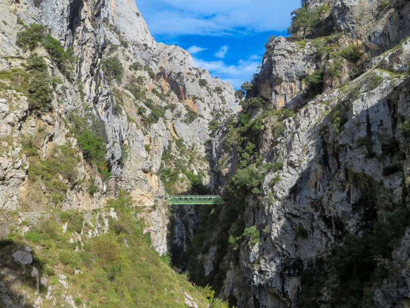


Perhaps the most famous and best hike in the Picos de Europa is the Cares Gorge hike, or the Ruta del Cares. The Cares Gorge is beautiful and boasts incredible views of the jagged limestone peaks. The Ruta del Cares follows along the Cares River with opportunities to cross the river via unique bridges.
Another adventurous aspect of the Cares Gorge hike is the chance to walk through stone caves blown out of the mountainside. Hikers love the curious goats that walk free along the Ruta del Cares.
The Cares Gorge hiking trail is mostly flat, but if you look down into the Gorge, you’ll see it’s very steep, sometimes as deep as 2,000 meters (6,562 ft), and there are no guardrails. Be careful to mind your footing and to stay on the trail at all times.
The Cares Gorge trail is accessible from two different points: Poncebos Asturias or Caín de Valdeón, a small village found in the Castille & Leon region of the Picos de Europa.
The Ruta del Cares hike is 7.5 miles one-way (12 KM), so if returning to Poncebos, the entire hiking route will be nearly 15 miles (24 KM). If you wish to break up the hike with an overnight, there are two accommodations in Cain de Valdeon near the trailhead, La Casona de Palmira and Hostal La Ruta.
It’s worth noting that the actual route can continue all the way to Posada de Valdeór, but the trail between Cain and Poncebos is the typical hiking route.
🥾 Cares Gorge Hike | PR-PNPE 3, Ruta del Cares | Difficulty: Easy – Moderate | Distance: Under 7.5 Miles Each Way (12 KM or 24 KM round-trip) | Duration: 6 – 8 hours | Trail markers: Yellow & White Rectangles | View & Download Ruta del Cares Map
3 | Poncebos to Bulnes Hike

One of the most beautiful villages in the Picos de Europa is Bulnes. Bulnes village is actually made up of two hamlets: Bulnes de Arriba (High) and Bulnes de Abajo (Low). The two mountain villages are connected via a scenic path and boast lovely viewpoints.
Bulnes has a population of 34 residents, but the village survives on its charm from tourism. There are a number of cafes, restaurants, a small church, and the Mirador de Bulnes.
The hike to Bulnes from Poncebos is a fairly steep uphill climb. The route is a small section of the multi-day La Reconquista trek. The hiking trail from Poncebos to Bulnes is referenced as La Canal del Texu route.
There are a few places to stay in Bulnes, so if looking for some true tranquility or opting to do one of the more challenging hikes to the mountain huts, sleep in Bulnes. The village of Bulnes makes an excellent base for hikers who are seeking a little more comfort than the rustic bare bones of a mountain hut.
Bulnes is connected to a few of the best Picos de Europa hiking trails. From Bulnes, it’s possible to hike to the green landscape of Pandébano Pass, which has lovely views of Naranjo de Bulnes. From the pass, either continue to the highest village in the Picos de Europa, Sotres, or visit the mountain hut at the base of Naranjo de Bulnes, Refugio Vega de Urriellu.


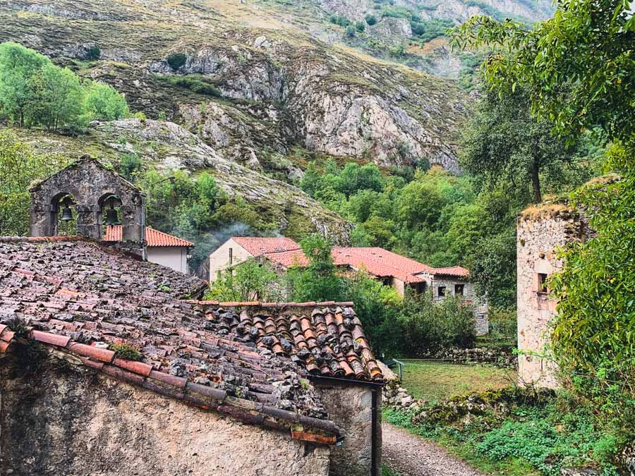
The village of Bulnes is accessible from two points: Poncebos or Sotres. Since this hiking guide focuses on hikes from Poncebos, the La Canal del Texu hiking route from Poncebos to Bulnes is 2.8 miles (4.5 KM).
If you don’t feel like hiking to Bulnes, it’s possible to ride the Bulnes Funicular from Poncebos Asturias. The Bulnes Funicular takes only 7 minutes but comes with a steep price tag of 22.16 Euros for a round-trip ticket.
🥾 Poncebos to Bulnes Hike | Part of the GR-202 Ruta de la Reconquista Route with this section of the route known as La Canal del Texu | Difficulty: Moderate | Distance: 2.8 Miles One-Way (4.5 KM) | Duration: 1 – 1.5 hours | Trail markers: Red & White Rectangles
4 | Refugio Jou de los Cabrones

One of the toughest Picos de Europa hiking routes from Poncebos is to Refugio Jou de los Cabrones. The Refugio Jou de los Cabrones is the highest mountain hut in the Asturias region of the Picos de Europa at nearly 6,675 feet (2,034 m).
Jou de los Cabrones is said to be one of the most isolated mountain huts in the Picos de Europa.
The route is accessible from Poncebos and continues to Bulnes de Arriba, or Bulnes – El Castillo. From there, the trail enters the Amuesa Canal and into the high mountains of the Picos de Europa via a steep and uneven trail. Be mindful that this route also utilizes ropes to navigate the steep and rocky pathway.
Due to the extreme difficulty of this Picos de Europa hiking route, it is not recommended to complete this trail as a full-day hike. The best options are to sleep in Bulnes or reserve one of the 20 beds at the Jou de los Cabrones shelter. This refugio also has basic food services available.
☛ Reserve a night at Refugio Jou de los Cabrones
🥾 Refugio Jou de los Cabrones Hike | PR-PNPRE 18 Jou de los Cabrones | Difficulty: Extremely Difficult / not recommended as a day hike | Distance: 5.28 Miles Each Way (8.5 KM) / steep with an elevation change of over 5,840 ft (1,780m) | Duration: 5 hours 45 minutes (one-way) | Trail markers: Yellow & White Rectangles
5 | Refugio Vega de Urriellu

Another Picos de Europa hiking route from Poncebos is to Refugio Vega de Urriellu. This mountain hut sits at the base of the most iconic peak in the Picos de Europa: Naranjo de Bulnes. The unique limestone peak of Naranjo de Bulnes is 8,264 feet tall and can be seen throughout sections of the Picos de Europa National Park.
There are multiple hiking routes from Poncebos to Vega de Urriellu, so find which route suits you. The hike to Refugio Urriellu can be either an out-and-back trail or a full circuit loop.
Routes to Refugio Urriellu include the PR-PNPE 19 Sendero Canal de Camburero from Bulnes and the PR-PNPE 21 Vega de Urriellu from the Pandébano Pass. The following two routes can be combined in a circular route. Here is an example of a detailed map and description of the circular trek to Refugio Vega de Urriellu.
It is highly recommended to break up the hike to Refugio Vega de Urriellu over two days due to the distance and difficulty, no matter which route you choose. Stay in Bulnes, sleep in Sotres, or reserve one of the 96 beds at the actual mountain hut of Vega de Urriellu.
➜ Reserve your spot at Vega de Urriellu here
🥾 Refugio Vega de Urriellu Hike | PR-PNPE 21 Vega de Urriellu or PR-PNPE 19 Sendero Canal de Camburero or Both | Difficulty: Difficult to Extremely Difficult depending on route / not recommended as a day hike | Distance: Depends on which route | Duration: multi-day trek
6 | Poncebos Asturias to Sotres Asturias

Sotres is the highest mountain village in the Picos de Europa at an altitude of 3,445 feet (1,050m). Today, it’s possible to reach the village of Sotres by car, but the hiking route from Poncebos is lovely and scenic.
The route from Poncebos Asturias follows along the Ruta del la Reconquista through Bulnes, Pandébano Pass, and continues through the unique Invernales del Texu. Here find winter huts that shepherds utilized for their livestock. The stone buildings are mostly abandoned, but make for an interesting and beautiful stroll.
Instead of continuing further on the Ruta de la Reconquista, head uphill via the road to the village of Sotres. For safety, make sure to walk on the left side of the road.
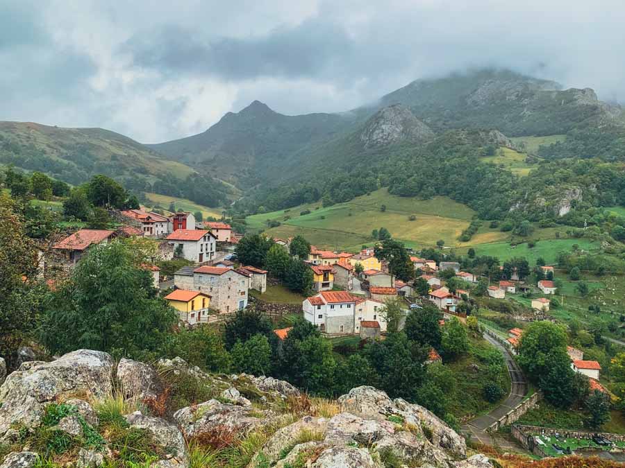
This colorful Asturias village is home to the distinctive Cabrales cheese shops and a handful of restaurants and bars. There are also quite a few Sotres accommodation options. Sotres is a delightful village in the Picos de Europa to relax, grab a drink, and rest.
From Sotres, it’s possible to catch a bus back to Poncebos, hike back to Bulnes on the same trail, or continue to the Asturias village of Tielve.
🥾 Poncebos to Sotres Hike | Part of the GR – PRPE 202 Ruta de la Reconquista | Difficulty: Moderate | Distance: 8.2 Miles one way (13.2 KM) | Duration: 5.5 hours | Trail markers: Red & White Rectangles and then follow the road into Sotres
7 | Poncebos Full Circuit Asturias Villages Hike

One of the best hikes in the Picos de Europa to experience the mountain villages is a circuit hike from Poncebos. This full-day hike showcases the picturesque hilltop Asturias villages of the Picos de Europe. It’s also great because it does not go deep into the high mountains.
The following Picos de Europa hiking route includes Poncebos ➜ Bulnes ➜ Sotres ➜ Tielve and finishes in Poncebos.
🥾 Poncebos Asturias Villages Circuit Hike | Follows Multiple Routes including GR – PRPE 202 Ruta de la Reconquista to Sotres and a part of the PR-PNPE 20 Monte Camba | Difficulty: Moderate | Distance: Around 15 miles (24.3 KM) | Duration: 8 – 10 hours | Trail markers: Varies along the Route | View & Download the Poncebos Circuit Hike Map
8 | Ruta Rio Casaño


Although not technically accessible from Poncebos, the Ruta Rio Casaño is a lovely day hike and is extremely different than most Picos de Europa hiking trails, as it sits at the foothills of the Picos de Europa.
This scenic day hike follows the Casaño River and twists through an enchanted chestnut forest, passes by waterfalls, and includes alternative views of the stunning limestone cliffs. The trail is an out-and-back trail.
The Ruta Rio Casaño trailhead starts in the village of La Molina, which is easy to reach via bus or taxi from Las Arenas de Cabrales.
This lovely hiking trail is a quiet and tranquil hiking option to see a different side of the Picos de Europa National Park.
🥾 Ruta Rio Casaño Hike | Difficulty: Easy – Moderate | Distance: Around 5 miles round trip (8 KM) | Duration: 4 – 5 hours | Trail markers: No Official Trail Markers, but the trail is defined | View & Download my Ruta Rio del Casaño Hike Map
Picos de Europa Hiking Tips
Here are some useful tips for planning a hiking trip to the Picos de Europa.
Do I Need a Guide for Hiking the Picos de Europa?

All of the Picos de Europa hiking trails can be completed independently, as the trails are well-marked and frequented by hikers. However, some of these trails are steep and narrow, so it’s possible to hire a professional mountain guide if that makes you feel more comfortable.
For safety, as many of the trails are steep and narrow, always stay on the trail.
Be mindful that if you are interested in climbing Naranjo de Bulnes, the most famous Picos de Europa peak, you must hire a professional guide.
When is the Best Time for Hiking the Picos de Europa?

The Picos de Europa can be visited any time of the year, but the best time for hikers is the summer months from June to September. However, this also equates to the busiest time, and many of the trails will have lots of hikers.
Many of the villages rely on tourism, so it’s important to book a place in advance if visiting during the peak season.
In May, some of the mountain passes may still have snow, so you need to have the proper equipment and gear. I’ve visited the Picos de Europa multiple times in the off-season (October – November). Each time, I had fairly decent weather. Surprisingly, I had more rain in October than in November.
The shoulder seasons of April to May and October to November are nice if not attempting any high-mountain Pico de Europa hiking trails. Be mindful that in the winter months, many of the mountain huts shut down, and there are fewer restaurants and accommodation options open in the villages.
The Picos de Europa National Park contains high mountains, and the weather can change fast and can even vary as you move up and down in elevation, no matter what the season.
Never venture out in extreme fog or in stormy weather. Lots of rain and snow can make the limestone rock paths slippery and dangerous.
How to Get to Poncebos in Asturias

Another reason it’s great to visit the Picos de Europa in the summer months and the start of fall is that you don’t need a car. It’s possible to visit Poncebos and the other mountain villages in Asturias via public transportation.
The bus company ALSA runs daily buses from June 1 to October 16 and often has a special schedule that coincides with Semana Santa in April (Holy Week).
If traveling outside the peak season, you will need a car to visit the Picos de Europa National Park, or only focus on one section of the park.
Oviedo to Poncebos
A popular way to get to Poncebos Asturias is by bus from Oviedo and on to Cangas de Onis. The famous Covadonga Lakes are found near Cangas de Onís. The Cangas de Onis bus station runs frequent buses to the Covadonga Lakes and daily buses to Las Arenas de Cabrales.
🚐 Cangas de Onís to Las Arenas de Cabrales | Bus Company: Alsa | One-Way Fare: €3.05 | Duration: 35 minutes | Departure: Cangas de Onis Bus Station/purchase tickets from the machines or La Estacion Cafe | Daily Departures: 5 / first at 6:45 a.m and last at 20:00 | Verify the bus schedule on the Alsa Website
Once in Las Arenas de Cabrales, simply catch a bus to Poncebos.
The bus from Las Arenas de Cabrales only takes 10 – 15 minutes to Poncebos and will drop off at the Hostal Poncebos or at the nearby parking lot for the Bulnes Funicular.
Buses depart from Las Arenas here, and a ticket to Poncebos costs €1.55 for a one-way ticket. Pay the driver upon entering the bus.
If you don’t want to wait for a bus, hire a taxi from Las Arenas de Cabrales to Poncebos for €8.
Llanes to Poncebos Asturias
Alternatively, if you’re enjoying the lovely coastal towns in northern Spain, like San Vicente de la Barquera or Ribadesella, head to Llanes. ALSA bus company runs a daily bus from Llanes to Las Arenas de Cabrales.
🚐 Llanes to Las Arenas de Cabrales | Bus Company: Alsa | One-Way Fare: €6.65 | Duration: 1 hour | Departure: Llanes Bus Station 33500 Llanes, Asturias, Spain | Departure time: 8:00 a.m. | Verify the bus schedule
Asturias Villages Bus Schedule

Once in the Picos de Europa National Park gateway village of Las Arenas de Cabrales, it’s easy to get to Poncebos by bus.
Remember, this bus route runs seasonally from June until mid-October
The buses stop at the Hostal Poncebos or at the parking lot for the Bulnes Funicular. At this stop, you will need to transfer from the full-size bus to a small van if you wish to visit the villages of Tielve and Sotres.
Bus fares are €1.55 from Las Arenas to Poncebos Asturias or €3 for a round-trip ticket. The bus fare from Poncebos to Tielve or Sotres is the same price.
If traveling from Las Arenas to Tielve or Sotres, the one-way bus fare is €2.60, or €5 for a round-trip ticket.
The only two ways to reach Bulnes village from Poncebos are to take the Bulnes Funicular or hike to Bulnes.
Las Arenas to Sotres Bus Schedule
The buses run from Las Arenas de Cabrales ➜ Poncebos ➜ Tielve ➜ Sotres
| Las Arenas | Poncebos | Tielve | Sotres |
| 8:00 | 8:30 | 8:40 | 8:50 |
| 9:00 | 9:30 | 9:40 | 9:50 |
| 10:00 | 10:30 | 10:40 | 10:50 |
| 11:00 | 11:30 | 11:40 | 11:50 |
| 12:00 | 12:30 | 12:40 | 12:50 |
| 13:00 | 13:30 | 13:40 | 13:50 |
| 17:00 | 17:30 | 17:40 | 17:50 |
| 18:00 | 18:30 | 18:40 | 18:50 |
| 19:00 | 19:30 | 19:40 | 19:50 |
Sotres to Las Arenas Bus Schedule
If hiking through some of the best Asturias villages, and you become tired or the weather changes, it’s possible to catch a bus back to Las Arenas de Cabrales or Poncebos.
The buses run from Sotres ➜ Tielve ➜ Poncebos ➜ Las Arenas de Cabrales
| Sotres | Tielve | Poncebos | Las Arenas |
| 9:00 | 9:10 | 9:30 | 10:00 |
| 10:00 | 10:10 | 10:30 | 11:00 |
| 11:00 | 11:10 | 11:30 | 12:00 |
| 12:00 | 12:10 | 12:30 | 13:00 |
| 13:00 | 13:10 | 13:30 | 14:00 |
| 17:00 | 17:10 | 17:30 | 18:00 |
| 18:00 | 18:10 | 18:30 | 19:00 |
| 19:00 | 19:10 | 19:30 | 20:00 |
| 20:00 | 20:10 | 20:30 | 21:00 |
What to Pack for Hiking in Picos de Europa
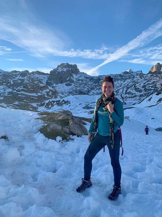
When hiking the Picos de Europa, it’s important to have the proper equipment.
Water can be scarce in the high mountains, so it’s recommended to carry at least 2 liters of water per person. There are some water fountains on a few of the listed hikes from Poncebos, but when stopping in the mountain villages, make sure to replenish supplies and water.
Day Pack
For short hikes, a small day pack will suffice. I love my Osprey Daylite Pack. If opting to sleep in the Asturias villages or at the mountain huts, you may opt for a larger hiking backpack, like one around 36 L.
Refillable Water Bottle
I carry a Hydro Flask Lightweight water bottle and a small collapsible water bottle like this one. For hiking in the Picos de Europa, you shouldn’t need a water filter system if utilizing the water fountains, but the water is not treated.
Be mindful of farmland animal waste if choosing to refill from natural sources. If using natural water sources, you may wish to carry a water filtration system.
Hiking Shoes & Hiking Poles
If doing casual hikes like the Cares Gorge or Rio Casaño hike, a good trail runner will suffice. I think Salomon trail runners are top-notch. Another brand to check out is Altra trail runners. I fell in love with Altras after walking and packing extra light on the Camino de Santiago.
If opting to hike the high mountain trails, it’s best to wear high-ankle hiking boots for ankle support. Again, I highly recommend Salomon hiking boots. The weather can change quickly, so GORE-TEX hiking boots can make a great option, especially if hiking in the Picos de Europa during the shoulder season.
Hiking poles are useful, especially if encountering rain or snow in the high mountains.
Hiking Safety Gear
Always carry a lightweight first aid kit. I never leave for a hike without at least one emergency blanket stuffed into my pack. A whistle is never a bad idea in case of an injury, or if getting caught in bad weather and accidentally straying off the trail. A small compass can also be valuable.
A headlamp is important, even for walking the Ruta del Cares, which passes through some small caves and can be dimly lit. Sometimes hikes can take longer due to weather or other causes, a headlamp should always be in your pack.
I never leave for a day hike without at least one extra battery pack for my phone.
Layered Clothing
A lightweight rain jacket is ideal since the weather can change instantly. I also love a buff to help protect me from the sun and insects. I swear by these lightweight Smartwool Merino Base Layer shirts, which add a layer of warmth and help with sun protection.
If planning for a full-day hike or sleeping at the Picos de Europa mountain huts, make sure to have extra warm clothing, like a fleece or a thicker Merino Wool Sweater. I love fleece leggings for cold mountain nights.
I often carry at least one extra pair of Merino Wool socks in case they get wet or my feet sweat. My best Camino tip was to break and change out my damp socks, so I do this when hiking long distances, no matter where the trail is. For overnights, I carry at least two pairs of extra hiking socks.
Snacks & Food
Make sure to carry enough snacks and food. Hostal Poncebos offers a picnic lunch for day hikers that includes a huge sandwich, water, choice of drink, chips, and a treat, all for 6 Euros.
Sleeping at the Picos de Europa Refugios
If opting to sleep at the Mountain huts, it’s not a bad idea to carry a lightweight sleeping bag or a sleeping bag liner. I’ve recently switched over to the Sea to Summit Spark Ultralight Sleeping Bag 40F, which doubles as a sleeping bag and a liner for intense treks. I’m not disappointed one bit by it.
Make sure to pack warm clothing for at night and extra dry socks. A small towel can come in handy, too.
➯ Hey… don’t forget your Travel Insurance! I love SafetyWing
Places to Stay When Hiking Picos de Europa from Poncebos
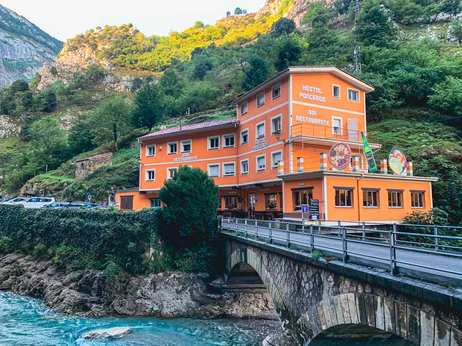
If staying in Poncebos, there are three Poncebos accommodation options:
💬 Real Talk | I’ve stayed at Hostal Poncebos and found the family to be so welcoming and warm! Every morning, my coffee was made without me even ordering it. They are helpful for calling taxis, giving hiking advice, and just going above and beyond. The food at the restaurant is delicious and hearty, and the best part is that the food comes at more than a fair price. Don’t forget about the quick and convenient picnic bag lunch options for hikers and day-trippers.
Alternatively, there are a few places to stay in Bulnes, which is a great place to sleep in the Picos de Europa for hikers. You can reach Bulnes via the Bulnes Funicular or on foot.
Bulnes Accommodation Options
✔ Alojamiento Rural – La Aldea de Bulnes
✔ Apartamentos turisticos El Caprichu de Bulnes
If you want to sleep in the highest Asturias village in the Picos de Europa, opt to stay in Sotres. Remember, you can reach Sotres via bus from Las Arenas de Cabrales or Poncebos during the peak season.
If planning on sleeping in the high mountains of the Picos de Europa, you must make a reservation for the Refugios.
➜ Here is the official reservation website for the Picos de Europa Refugios
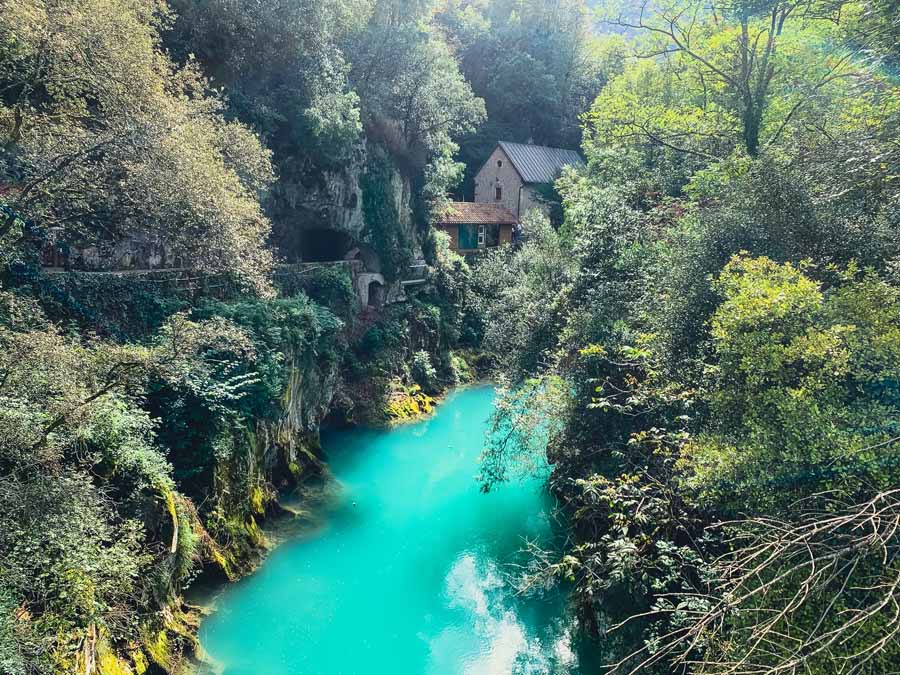
Those looking for convenient access to the other regions of the Picos de Europa and are maybe more focused on the Asturian cuisine, museums, and cheese tours may choose to stay in Las Arenas de Cabrales.
There are tons of hotels, guesthouses, casas rurales, RV parking, and camping options in Las Arenas de Cabrales.
➯ Where to Stay in the Picos de Europa
Conclusion | Picos de Europa Hiking Trails from Poncebos Spain
In short, these are some of the best Picos de Europa hikes that are accessible from Poncebos. These Pico de Europa hiking routes showcase the natural beauty of the limestone mountains and include charming Asturian villages. These trails highlight the picturesque landscape of northern Spain.
Poncebos Asturias is an excellent base in the Picos de Europa for hikers!
This Picos de Europa hiking guide highlights the small hamlet of Poncebos. This hiking guide also includes how to get to Poncebos by public transportation, the best hikes from Poncebos, general Picos de Europa hiking tips, and what to pack for hiking in the Picos de Europa, Spain.
Don’t miss a chance to experience the best Picos de Europa hiking trails from Poncebos!
Have you been to the Picos de Europa National Park and visited Poncebos? Did you complete any of these hiking routes from Poncebos, or am I missing a hike from Poncebos that you absolutely loved? Let me know in the comments below!
Pack This Post for Later! Pin It!

Disclaimer: There’s a chance this post contains affiliate links, and I receive a small (but grateful) portion of the sale. There’s no extra cost to you, and I only promote things that I use and love.


Hi Megs: Awesome website. Was unclear whether you had done the hike up from Bulnes to Refugio Jou de Los Cabrones? If you did can you advise on a couple points? We are considering doing the same hike although we hope to spend the night at the Refugio.
For context, we’ve hiked a fair bit thru the Stubai alps, dolomites etc. We are not technical climbers just solid trampers:
(a) In the hike up to Refugio Jou de los Cabrones there is a section where we use a rope to get up the slope. Do we have to depend on the rope to find our way up or is it more like we are climbing up but using the rope for protection and to provide addl support? I am asking because neither my husband nor I could climb up a rope you know, like we couldn’t rappel ourselves up the rope with a backpack i don’t think? But if it is like a low grade Via Ferrata where we could climb up rocks while holding onto a rope that would be doable. Can you advise?
(b) Once you get over the rope section, the other side from other blogs/videos look pretty steep. can we find footings in the crevices and pretty much find our way down? It would be sad to overstate our skill level and get to that point and then be unable to go further.
(c) In checking out the hiking path at various points it almost seems like a social path. We will have Gaia GPS, but where would we find a paper map, and what else did you use to ensure you were on the right track? Or am I mis-stating and it’s fairly well sign-posted?
(d) We are planning to do this hike (if we can) in late September 2023. Any ideas when the snow fall comes thru in these areas?
Thanks for all your advice, and would much appreciate your insight on these points.
Best Regards, Chitra
Hey Chitra-
I was not able to complete the Bulnes to Refugio Jou de los Cabrones due to bad weather. I have visited the Picos de Europa twice, once at the end of September and once during the beginning of November. I had bad weather and storms in the high mountains during September, so I had to walk on trails in the lower part of the National Park. It’s on my list for next time.
When I visited in November, there was snow on some of the high mountain trails and I did not have the proper gear to hike the higher elevation trails.
The hiking trails in the Picos are well-signposted, but I always check-in with an offline map for areas that appear unclear. I find Maps.me works well as hikers add in signboards and notes, but does not provide elevation profiles. I did check-in with my map more often on rainy days when the visibility wasn’t as clear. You will see hikers out on the trails, but the higher into the mountains, the fewer the hikers.
I can’t advise on the chain as I only saw it in my research. I do not repel and do not carry equipment for it.
There are guides at the Bulnes funicular station that can offer advice on current trail conditions. During my visit the guides were not fluid in English, so some Spanish can come in handy. The only route that requires a guide is for climbing Naranjo de Bulnes. Ultimately, you will have to be the one who accesses if this hike seems to align with your abilities.
If visiting in September you will have to be mindful of the weather. At this altitude the weather can change instantly and you might have to divert plans (which is what happened to me). However, there are plenty of things to do on rainy days, including cider houses, museums, and lower trails.
Hope this helps and that you enjoy your time in the Picos!
Megs