
Peñalba de Santiago to Montes de Valdueza to Villavieja Mountain Hike
- Created: April 3, 2024 2:00 pm
- Updated: April 10, 2024 12:37 am
- Distance Instructions
- Travel mode
- walking
- bicycling
- driving
- straight-line


- Distance 17 miles
- Time 8 h 0 min
- Speed 0.0 mph
- Min altitude 2556 ft
- Peak 4898 ft
- Climb 4127 ft
- Descent 5154 ft
This is a quick overview of the hike from Peñalba de Santiago to Montes de Valdueza and onto the historical Camino de Invierno city of Villavieja. This is a challenging hiking path that twists through the enchanting Valle del Silencio (Valley of Silence) and highlights the untouched beauty of the Aquilianos Mountains.
This is day 2 of the multi-day high mountain trek. In all honesty, It is better to hike this route over 3 days due to the steep ascents and descents. I was fairly exhausted pushing myself to walk it over 2 days due to the steep ascents and descents.
Recommended Route
| Day | Daily Stages | Distance | Duration |
| 1 | Ponferrada ➜ Peñalba de Santiago | 20.5 Km (12.75 miles) | 5+ Hours |
| 2 | Peñalba de Santiago ➜ Montes de Valdueza | 8.5 Km (5.25 miles) | 3+ Hours |
| 3 | Montes de Valdueza ➜ Villavieja via Ferradillo | 20 Km (12.5 miles) | 5+ Hours |
🗺️ Day 1 Map Ponferrada to Peñalba de Santiago
If following along from the first day, this route starts from the medieval city of Ponferrada and stops at the tiny mountain pueblo of Peñalba de Santiago.
This next section will focus on the mountain route between Montes de Valdueza that continues to Ferradillo and onto Villavieja.
I hiked this strenuous path as an alternative way to join the Camino de Invierno in Villavieja.
Remember, this is not an official Camino de Invierno path and there are no Camino de Santiago markers or signage. This is not a typical route to "follow the shells," but rather, a tough trail that takes experienced hikers through the mountains and some of the most untouched landscapes of the Aquilianos Mountains. You must feel comfortable walking on quiet mountain trails and be able to follow an offline map. Make sure to carry enough food as there are no services in Montes de Valdueza or Villavieja, but there are kitchens available at the local albergues.
There is one small cafe in Monte de Valdueza (La Cantina de Sara / +34 987 695 194), but it's best to verify that they are open, especially during the off-and-shoulder season. When I passed it was not open.
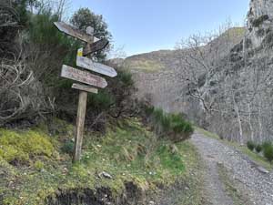
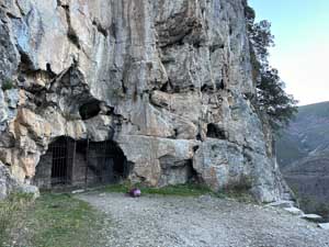
The following day from Peñalba de Santiago head out of town near the cemetery to Montes de Valdueza. This section of the trail is well-marked with signboards. I opted to take the out-and-back trail section to see the Cueva de San Genadio. These caves and areas have been famous for being the home to monastery communities and reclusive settlements since the 7th century. This is where the name “Valley of Silence" originates from and why there are so many ancient churches and an elevated feeling of spirituality.
The path is marked again with the yellow and white blazes of the Tebaida Berciana Route. Follow the signboards towards Montes de Valdueza. There is a trail split that offers a high mountain trail (Montes Por Collado) or a lower path that follows the old Roman water canals (Canal Romano). These old Roman canals were used to collect water for the famous gold mine of Las Médulas.
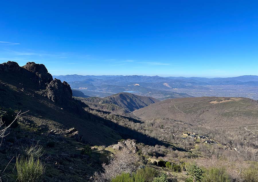
If the weather is good and you feel comfortable, the high mountain route is definitely worth it. The views looking back at Peñalba de Santiago were incredible. There's a gradual climb up, followed by a steep descent down. Catch those first glimpses of Monte de Valdueza in the distance. This route is exposed with no shade coverage and the markers can be hard to spot.
The two trails merge back on a section of the trail. The next section is challenging with a warning sign. The trail is narrow and has exposed stones. It also has a stream to ford via stones. Be mindful of your footing while crossing the section.
The way leads to Montes de Valdueza and the Monasterio de San Pedro de Montes that dates back to the 7th century. The front church facade is from the 18th century. I recommend sleeping here to break up the long stage to Villavieja.
The Monasterio de San Pedro de Montes has a wonderful albergue with a kitchen. Make sure to verify they are open, I missed the opening date and was totally bummed. The next stage is tough, so sleeping in Montes helps break up the challenging stage (just make sure to take enough food).
The stage from Montes de Valdueza to Villavieja is tough. It's a straight climb out of the village and through the Valle del Silencio. Be mindful that there are lots of cattle in this area with mastiffs guarding them. I didn't have any trouble with cattle dogs. This trail section is exposed with no shade coverage and minimal (almost no) trail markings. Make sure to check in with an offline map to head towards Campo de las Danzas.
The trail is long and continues its ascent. After the area labeled El Collado (mountain saddle with many trail splits) I noticed that some sections of this area have been damaged (due to logging or fire?). I tried to stay on the most obvious trail due to the current state of some of the trails (2024).
The wide gravel trail soon merges with a local paved road. The road leads to a large open parking area with lots of trails marked with a stone (Campo de las Danzas).
As you can see on my map I followed a trail that was so severely damaged that it was closed (I also saw a wolf here). The trail was in such despair that I had to turn around and regroup.
I returned to the main area and rerouted to a different path. This was a much better trail option and it was a stunning path. I turned to the right walk alongside the unique mountains of Peña de Ferradillo to get my first distant views of Ferradillo. Follow the gravel road and look for the sharp left turn down the steep hillside that leads to the fountain to the entrance of Ferradillo. There is a fountain at the entrance of this beautiful abandoned village.
In Ferradillo, join the official trail of the Ruta Peña del Hombre. This trail is marked with yellow and white blazes and twists through an incredible forest. This section is fabulous and follows along the stream. It can be muddy if there has been a lot of rain. Find old water mills and spectacular scenery. The route is officially a loop, but if continuing on the Camino de Invierno, you'll stop once you reach Villavieja.
Here is my Peñalba de Santiago to Villavieja hiking map that is best hiked over two days.
⁉️ If downloading the Peñalba de Santiago to Villavieja map, please verify that the map is correct and follows the waypoints. Oftentimes, there are daily updates to the site, map platforms, and other external issues that may cause a bug in downloading. Be mindful that this map is solely for entertainment purposes. See my full disclosure here. Always hike responsibly and respect the mountains by following a no-trace philosophy, avoid hiking alone, be conscious of the weather and personal limitations, and do not stray from the visible trail
Peñalba de Santiago - Montes de Valdueza - Villavieja Hike Logistics
- Point to Point Trail
- Peñalba de Santiago to Villavieja via Montes de Valdueza and Ferradillo
- Official Trail Markers: The route does not have Camino de Santiago markers. The route between Peñalba de Santiago to Montes is marked via the PR LE 14 trail. There are no trail markers between Montes de Valdueza to Ferradillo. Once in Ferradillo, follow the marked trail of Ruta Peña del Hombre to Villavieja
- Difficulty: Very Challenging
- Limited signboards after Montes de Valdueza makes this route extra challenging
- Many of the trail sections are exposed with no shade coverage
- The ascent from Montes de Valdueza to Campo de las Danzas is tough. The descent to Ferradillo is also challenging
- Distance Peñalba de Santiago to Villavieja: 17.75 Miles (28.5 Km)
- Excursion Duration: At least 8 hours
- Be mindful of the weather in these high mountains. Many trail sections are exposed with no shade coverage and can be draining. In the winter, these mountains can be hit hard by snow. Always carry enough supplies, especially water and food. Many of these trail sections are isolated and I did see a wolf close enough to make me a little more alert.
- Essentials for Hiking from Peñalba de Santiago to Villavieja
- Offline Map from some source
- Extra Battery Pack for electric devices
- Water in a Reusable Water Bottle
- Trekking Poles if you love them
- Hiking Boots or trail runners
- Enough Food for 2 - 3 Days depending on where you start (Ponferrada to Villavija)
- These are all items included in my Camino Packing List
Where to Stay in Montes de Valdueza & Villavieja
This route is more manageable if separated over two stages by sleeping in Montes de Valdueza.
As the villages are small, make sure to have your accommodation options arranged before departure. The only accommodation option available in Montes de Valdueza is the Albergue found in the Monastery. For pilgrims walking the Camino de Invierno, Villavieja offers a great albergue. Both albergues have kitchens with ample supplies, so carrying food is essential.
There is one restaurant in Montes de Valdueza. Upon my arrival, it was closed, so make sure to verify before you depart from Ponferrada how much food you need to carry. Remember, Villavieja has no services, so food planning is important.
- La Cantina Sara in Montes de Valdueza (+34 987 695 194 )
- Albergue Monastery of San Pedro de Montes (+34 619 077 982 / Facebook ) / closed during the winter
- Municipal Albergue de Vilavieja “Manuel Fuentes” / Contact: Mon – Fri from 9:00 – 14:00 (+34 987 420 806) / Evening, Weekends, Festivals 11:00 – 20:00 +(34 606 898 140)
Valle del Silencio Hike from Peñalba de Santiago - Montes de Valdueza - Villavieja
This is a basic overview of the high mountain hike from Peñalba de Santiago via Montes de Valdueza to Villavieja. This is a challenging alternative route for the first stage of the Camino de Invierno. This map shows the main trail sections for the second ( and possibly third) day of the strenuous mountain hike.
For the complete hiking guide, photo inspiration, and more detailed information, read the complementing blog post:
1. Signboard
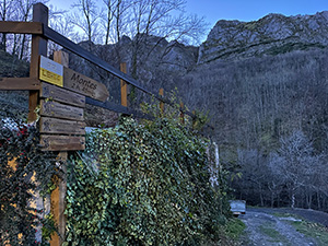
The signboard out of Peñalba de Santiago PR LE 14 to Montes
2. Signboard
3. Cueva de San Genadio
4. Route Split
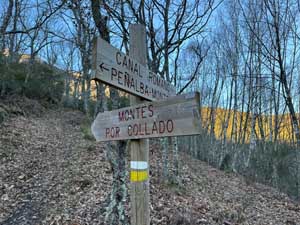
I opted to take the high mountain route (left)
5. Signboard
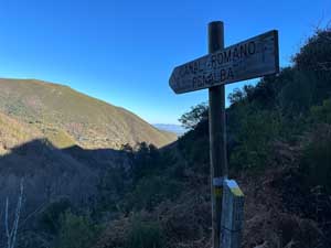
Where the Roman Canal and High Mountain Route merge. After this there is a dangerous route signboard indicating a narrow and rocky path
6. Monasterio de San Pedro de Montes
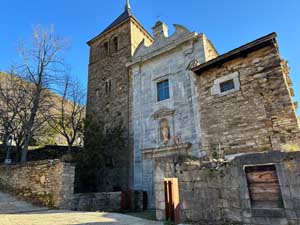
Arrive to Montes de Valdueza via the lower road to the Monasterio de San Pedro de Montes
7. El Collado
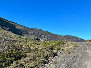
Mountain saddle with different trail options. To the left are views of the 12 Apostle Mountainface and to the right are distant views of Ponferrada
8. Campo de las Danzas
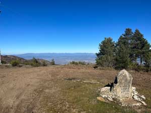
Open area with parking area and hiking trails with sprawling views of Ponferrada city
9. Damaged Route
This trail was completely devastated and closed. Deviate to alternative trail
10. Unmarked Descent
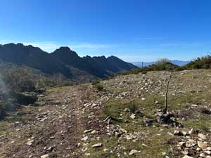
a steep descent down to the village of Ferradillo
11. Fountain Ferradillo

working water fountain at the entrance of Ferradillo village
12. Ferradillo Village
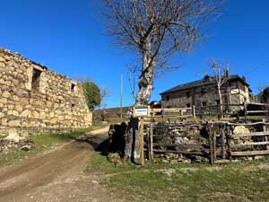
the beautiful and abandoned village of Ferradillo
13. Ruta Pena del Hombre - Cornatel Signboard

Official signboard with Ruta Peña del Hombre - Cornatel Signboard
14. Molino
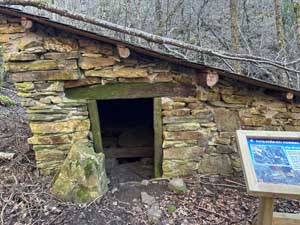
Old abandoned mill next to the stream
15. Villavieja Village
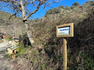
The route meets Villavieja village near the Saint James Fountain and on the route of the Camino de Invierno
16. Villavieja Albergue
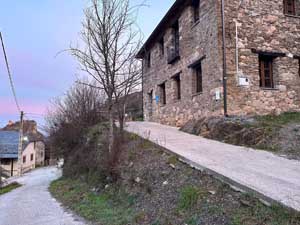
an excellent albergue to rest for the night. Make sure to pack food