
Hike the Incredible Oza Valley and Aquilianos Mountains in 2 or 3 Days
The Valle del Silencio and the untouched beauty of the Aquilianos Mountains are something special. Tucked away in the El Bierzo region of León, Spain, these mountains are blessed with tiny hamlets, lush forests, and spectacular mountain views. This area is part of the large Oza Valley (Valdueza Valley) and is one of the treasures of El Bierzo.
The gateway to this spectacular region is Ponferrada, a medieval city that has deep connections to the Camino de Santiago. In fact, I hiked in these river valleys and alongside these mountains as a strenuous alternative high mountain route on the Camino de Invierno.
This multi-day trek in the Aquilanos Mountains (Montes Aquilian) follows some of the region’s most beautiful river valleys, passes through quiet hamlets, twists through the Valle del Silencio, and connects to the Camino de Invierno.
This hiking guide features a suggested itinerary, highlights along the way, and practical planning tips for exploring this underappreciated region.
Here’s my multi-day trek guide to the underrated Oza Valley through the impressive Aquilianos Mountains and beyond.
Table of Contents
Disclosure: This is part of my Hikes & Adventures series, which means these treks can be strenuous and challenging. These are my experiences and I am not an expert. Please have all the proper equipment, verify the weather conditions, use professional resources, do your own research, be mindful of constantly changing trail conditions, and take into consideration your own physical abilities and/or limitations. These guides are for entertainment purposes only. Please see my full disclosure for more information here.
- Overview | Muti-Day Trek in the Aquilianos Mountains
- Maps & Overview of Aquilianos Mountains Trek
- Useful Tips for Hiking the Valle del Silencio and Aquilianos Mountains
- Daily Itinerary Ponferrada to Villavieja Trek Through the High Mountains
- Peñlba de Santiago
- Montes de Valdueza
- Villavieja
- How Much to Budget for a Multi-day Trek in the Mountain near Ponferrada?
- Conclusion | Hiking in the Oza Valley, Valle del Silencio & Aquilianos Mountains
Overview | Multi-Day Trek in the Aquilianos Mountains

This multi-day trek begins from Ponferrada, Spain, and passes through the hamlets of Peñalba de Santiago, Montes de Valdueza, Ferradillo, and eventually merges with the Camino de Invierno in Villavieja.
Highlights of this trek include the Oza River Valley, the Valle del Silencio, the Aquilianos Mountains, and two hamlets found in the municipality of Priaranza del Bierzo (Leon).
My hiking itinerary was based on walking the Camino de Invierno. It’s extremely important to note that this route is not your “typical Camino route,” since it passes through the high mountains and there are no Camino shell markers.
This multi-day trek is best for hikers who feel comfortable reading an offline map and have experience hiking on fairly isolated mountain trails.
While I walked this strenuous hike over two days, I highly suggest spending more time in these mountains. Over two days, I felt rushed, missed some highlights, and was exhausted by the time I arrived in Villavieja. This multi-day trek is more comfortable to walk over 3 days.
| Day | Itinerary | Distance | Duration |
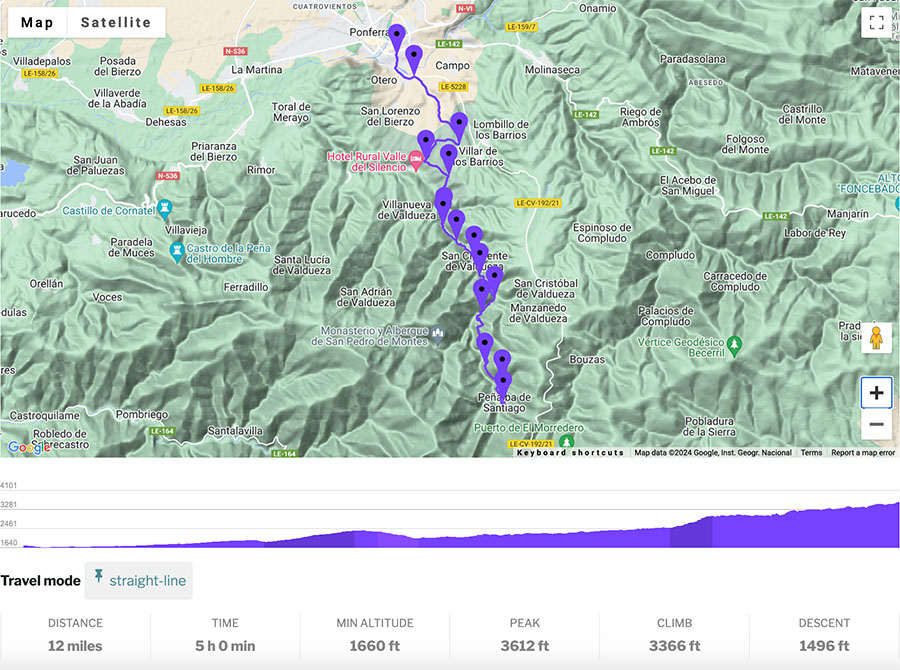
| 1 | Ponferrada ➜ Peñalba de Santiago | 20.5 Km (12.75 miles) | 5+ Hours |
| 2 | Peñalba de Santiago ➜ Montes de Valdueza | 8.5 Km (5.25 miles) | 3+ Hours |
| 3 | Montes de Valdueza ➜ Villavieja via Ferradillo | 20 Km (12.5 miles) | 5+ Hours |
Maps & Overview of the Aquilianos Mountains Trek
Stage 1 is less challenging than Stage 2. Peñalba de Santiago is one of Spain’s most beautiful villages, so it’s possible to arrange a taxi beforehand if looking to only hike the first stage.
Stage 1 Map
Stage 2 (&3) Map
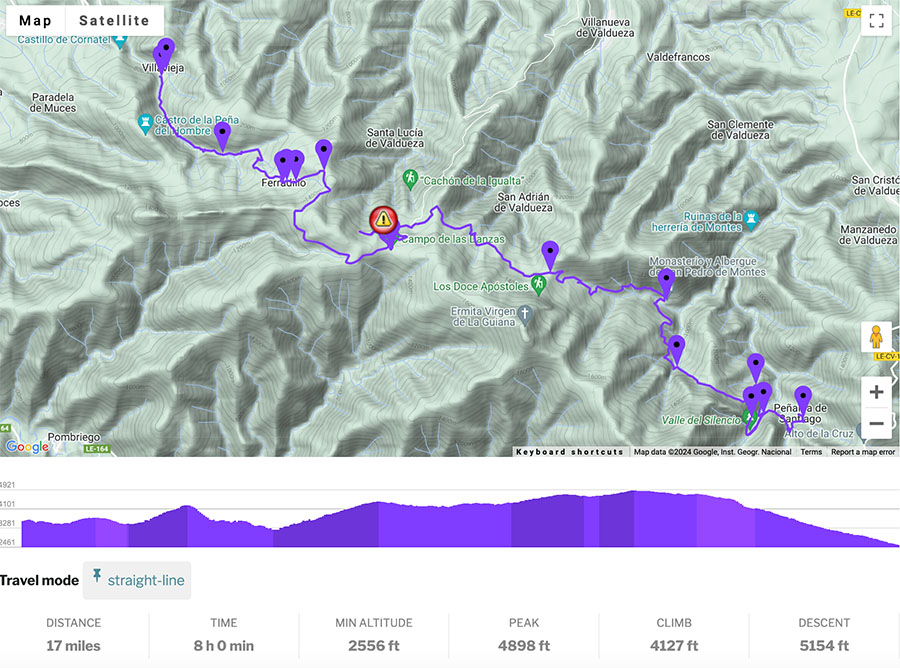
Stage 2 is long, so I think it’s best to break it up over 2 days by sleeping in Montes de Valdueza. I am an experienced hiker and I was feeling exhausted cramming this stage into one day.
General Overview of Montes Aquilianos Trek
- Point to Point Trail
- Ponferrada to Villavieja via Peñalba de Santiago – Montes de Valdueza – Ferradillo
- Official Trail Markers: Official Trail Markers are limited. If walking as part of the Camino, there are no Camino de Santiago trail markers
- Ponferrada to Valdefrancos village has no trail markers
- Valdefrancos to Herrería de Montes (ruins and water plant) uses local route signboards
- Herrería de Montes to Peñalba de Santiago officially marked as the PR LE 14 trail
- Peñalba de Santiago to Montes de Valdueza is marked with PR LE 14 markers
- There are no trail markers between Montes de Valdueza and Ferradillo
- Ferradillo to Villavieja is marked as the Ruta Peña del Hombre – Cornatel
- Difficulty:Challenging
- Limited signboards in some sections make this trek challenging
- Many of the trail sections are exposed with no shade coverage
- Limited services require hikers to carry enough provisions and food
- Numerous steep ascents and descents add time and distance to this route
- Isolated with barely any hikers in some sections
- Distance: 30.5 Miles (49 Km)
- Excursion Duration: 2-3 Days
- Essentials for Hiking from Peñalba de Santiago to Villavieja
- Emergency Blanket
- Reusable Water Bottle (Filled)
- Trekking Poles
- Hiking Boots or trail runners, whatever shoes you decide on for your Camino
- Pilgrim Credencial (Pilgrim Passport)
- Offline Map from some source
- Power Bank to make sure you don’t get stranded in the mountains with a dead phone and no offline map
- Enough Food for 2 – 3 Days
- All my gear was part of my Camino Packing List
➯ Hey… don’t forget your Travel Insurance! I love SafetyWing
5 Tips for Hiking in the Valle del Silencio & Aquilianos Mountains
Here are some of my best tips for planning the trek to the Valle del Silencio and the Aquilianos Mountains in Spain.
1 | Carry Enough Food
You must feel comfortable with enough food for your trek. Plan how many days you will walk in the mountains, and know that while there may be a cafe or restaurant open in one of the villages, there are no shops or stores to restock food supplies.
It’s best to verify what will be open on your route beforehand so you know how much food to carry. If you are planning on staying in the albergues in Montes de Valdueza and Villavieja, there are well-stocked kitchens at the Albergues.
My trekking route was Ponferrada ➜ Peñalba de Santiago ➜ Montes de Valdueza ➜ Ferradillo ➜ Villavieja
I never had issues with water, as I found numerous water fountains in villages and along the trail. I did not carry a water treatment system and had no problems with the water.
Restaurants & Cafes
- Ponferrada
- Numerous grocery stores, cafes, restaurants, STOCK UP HERE
- Peñalba de Santiago
- La Cantina Restaurant (+34 987 620 201 / Instagram )
- Aromas del Oza (+34 661 067 700)
- Montes de Valdueza
- La Cantina de Sara (+34 987 695 194)
- Ferradillo / NO SERVICES
- Villavieja/ NO SERVICES
If continuing on the Camino de Invierno, there are plenty of cafes and restaurants in Las Médulas, a village famous for its ancient Roman gold mines. (7.5 miles / 12 Km from Villavieja). There are also shops selling artisan goods in Las Médulas, but you won’t find a proper supermarket until Puente de Domingo Flórez (5.5 miles / 9 Km from the village of Las Médulas).
2 | Have an Offline Map
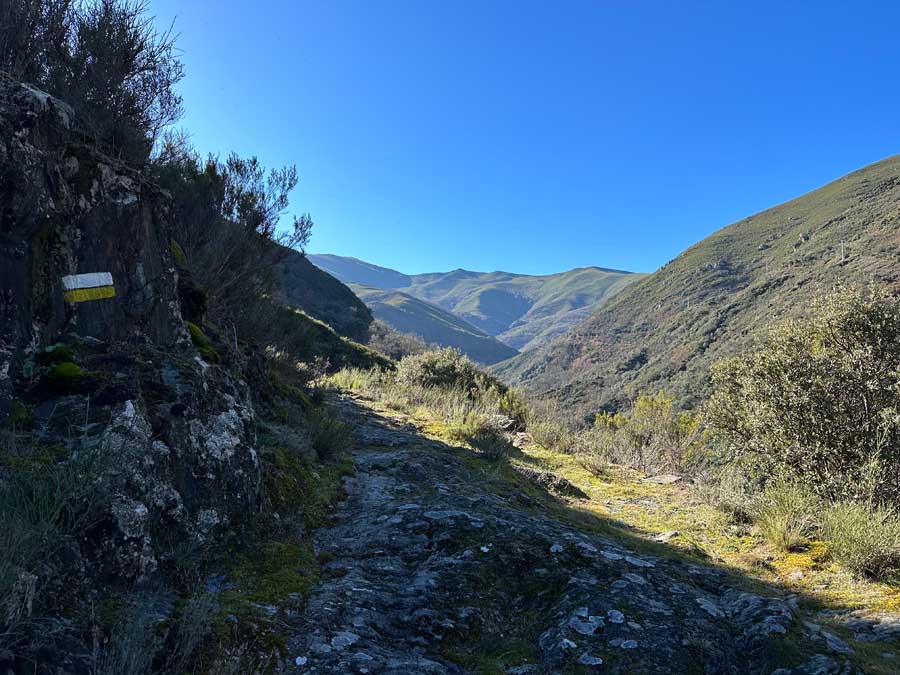
An offline map is essential for hiking in the Oza Valley and Aquilianos Mountains. Before departing Ponferrada, make sure to stop in at the Tourist Information Center, which has excellent resources and up-to-date trail information.
Leaving Ponferrada, I had to use an offline map until Herrías de Montes. A lot of the trails I couldn’t tell if they were private property, so I tried to take the most “obvious path” and followed the signboard for cars. Once up on the hillsides, I was hyper-aware of signage for villages and mountain bike trails.
The trail sections after Montes de Valdueza include numerous trail options to hike in the Aquilianos Mountains, many of which are unmarked. To reach Campo de las Danzas, I also relied heavily on an offline map.
Maps.Me is one of my favorite apps for people walking the Camino de Santiago.
While many sections are on forest and mountain trails, some trail sections follow local roads. For safety, make sure to always stay on the left-hand side of the road and try to walk next to the road.
As I relied on an offline map quite a bit, carry an extra battery pack. If you drain your phone there is no place to recharge it in the isolated hillsides.
3 | Be Mindful of the Weather & Wildlife
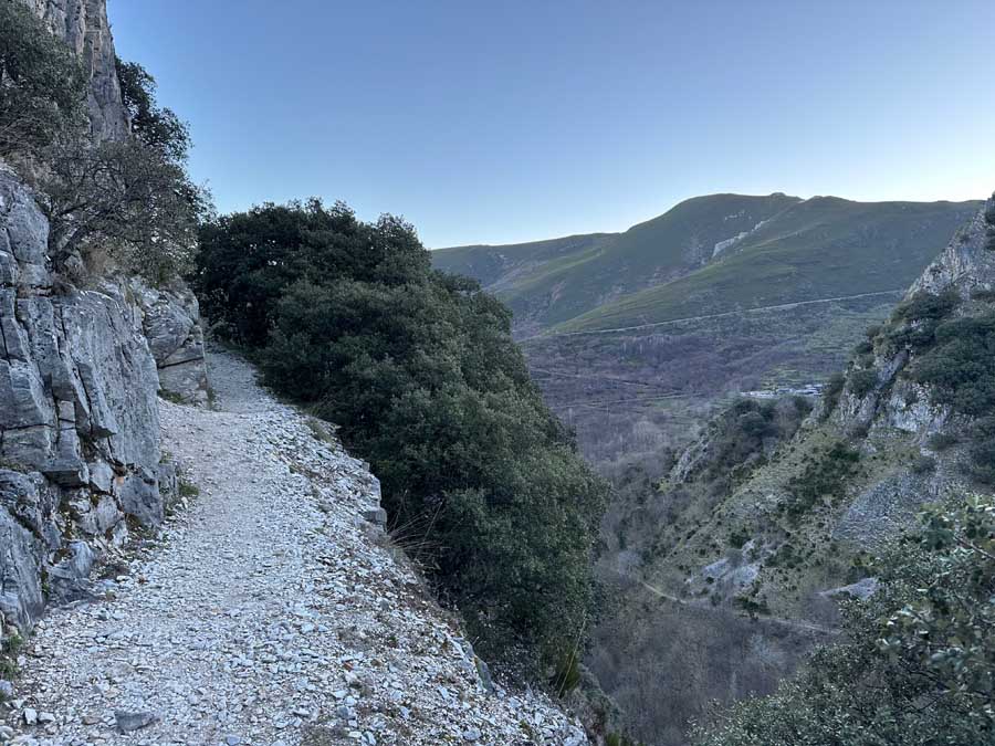
Many trails are found in the high mountains of the Montes Aquilanos range. With higher altitudes and river valleys, always be conscious of the weather. This is the mountains, so be prepared for the weather to change and carry the proper gear.
During the winter and shoulder seasons, these mountains are susceptible to snow. Additionally, some of the Albergues may be closed during the offseason.
With the summer months comes the challenge of extreme heat. It is not advised to hike mid-day in areas where there is little shade coverage. This would be most of the section from Montes de Valdueza to Ferradillo.
Many trail sections are also rocky, so they can become slippery and dangerous during heavy rains. In these mountains, be mindful of possible rock or landslides.
Some of the open and exposed trail sections pass through areas where livestock graze. Oftentimes, you may encounter unattended dogs (typically mastiffs). Respect these animals as they are doing a job protecting livestock from wildlife. I never had an issue with unattended dogs in these mountains, but I did see a wolf closer than I would have liked to.
These mountains are home to many species of wild animals like wolves and wild boar, so it’s best to be alert to your surroundings.
4 | Route Damages
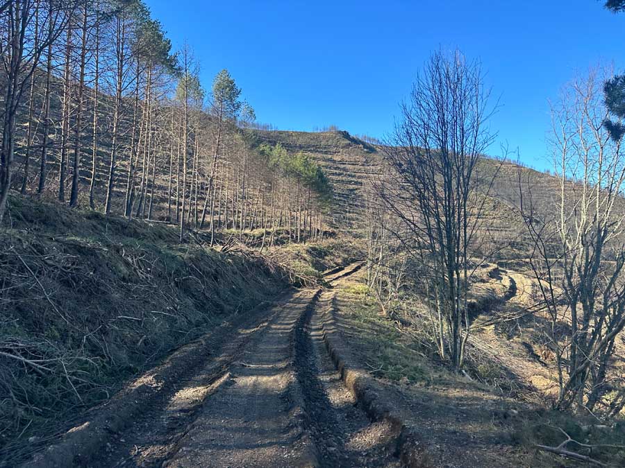
Some areas of these mountains have sadly been extremely disturbed by humans.
I found trail areas near Campo de las Danzas to be damaged from wildfires and logging. There was one trail section that was in such despair that I had to detour from the trail and reroute.
I am optimistic that the region is prioritizing restoring and rehabilitating these beautiful mountains.
Always follow the signs posted.
I walked on a trail that was marked with large red X’s, verifying the trail was impassible, which ultimately made me reroute. (It’s visible on my map).
5 | Respect the Mountains

The Aquilianos Mountains and Valle del Silencio are beautiful and powerful, with lots of energy. The “Valley of Silence” originates from the numerous monasteries and ancient churches that were founded in this area around the 7th century. Although it is believed monks and hermits could have settled here much before that.
Monks walked the mountains and spent time in the sacred caves of the hillsides. There is no denying an elevated feeling of spirituality in the quietness of these remote mountains.
This trekking route does not include hiking to the top of any mountain peaks. This route follows trails that run alongside the mountains, mountain saddles, and passes.
Always respect the mountains by practicing a leave-no-trace philosophy and staying on the marked trails. This trek is for those hikers who are in good physical shape, can read and understand an offline map, and are best suited for those who have experience hiking in the mountains.
If you’ve walked numerous Camino de Santiago routes, I would say this trek could be comparable to the Camino Dragonte, an alternative detour on the Camino Frances.
The Camino Dragonte starts from the hilltop village of Villafranca del Bierzo (northeast of Ponferrada) and is only a one-day hike. This trek is harder than the Dragonte route because there is less signage and spans over two to three days.
Daily Itinerary from Ponferrada to Villavieja via the Aquilianos Mountains


Here is my daily schedule for the Ponferrada to Villavieja trek through the Oza Valley, Valle del Silencio, and Aquilianos Mountains.
Although I hiked this route over 2 days, it’s best to hike it over 3 days due to the challenging ascents and descents. I also felt rushed, and 3 days would have been much more comfortable.
I’ve included the two stages of my mountain trek, but show how to break up this mountain hike over 3 days. Stage 2 is split over two days.
Day 1 | Ponferrada to Peñalba de Santiago (Stage 1)
The trail leaves Ponferrada via the Camino de Invierno, which starts near the Cruz de Miranda. This stone cross leads pilgrims past official sign markers over the Boeza River and its medieval bridge.
Pilgrims will continue right towards Villavieja on the Camino de Invierno, but to hike in the Valle del Silencio and the Aquilianos Mountains, you’ll need to head left. There are signboards for cars in the direction of Peñalba de Santiago.
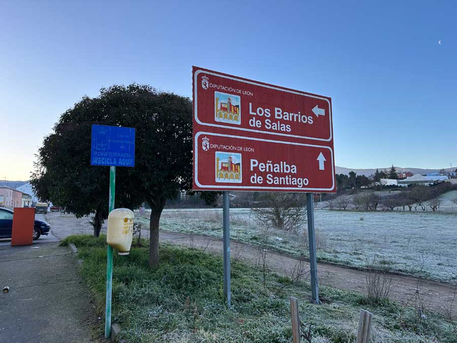
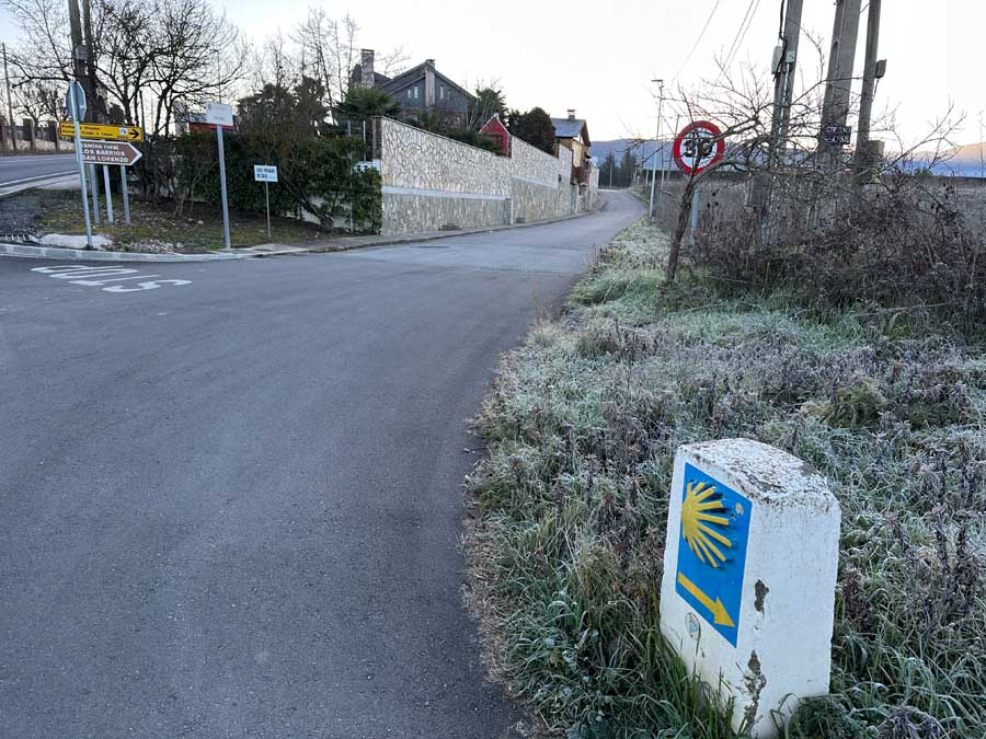

Follow the road until there’s a Camino de Santiago Marker that’s pointing in the direction you just came from (Ponferrada). This is a signboard for the pilgrims who detoured at El Acebo de San Miguel on the Camino Frances. This is the road to Peñalba de Santiago.
Follow the road past Bodega y Viñedos Heredad Morán & López (left-hand side). There are numerous “paths,” but I stayed on the road that turned to gravel until I approached a signboard for the Camino Rural. I took the path to the right, Camino Rural San Lorenzo.
An offline map is essential during this part because there are very limited sign markers. Again, there are numerous paths, I just tried to stay on the “most obvious” as I wasn’t sure what was private or public lands.
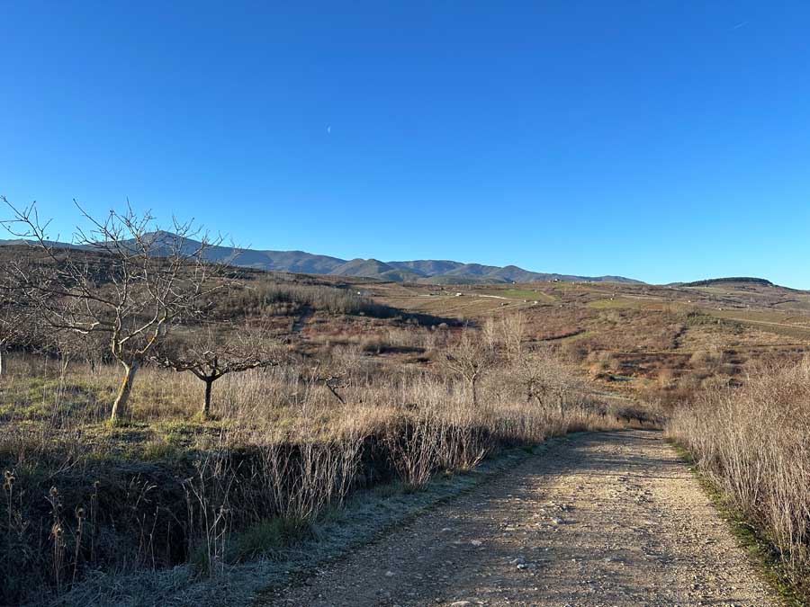
This is a short stint on a gravel road, and in about half a mile, take a left uphill. This provides excellent views looking back on Ponferrada. The gravel road comes to a section with many trail options. I headed towards the left, where I saw a Ruta BTT signboard for mountain bikers. I followed this route until I saw a yellow arrow pointing to the right. (An offline map is essential)
This steeper descent was quite muddy in the beginning, but it took me through a lovely forest section. The trail continues to meet the road LE-5238. Turn left to walk on the road that leads to Valdefrancos village.
This village welcomes us to the incredible Oza Valley. It also goes by the Valdueza valley, which is why many of the villages include this name.
From here, it’s a gradual ascent all the way to the Herrería de Montes split.
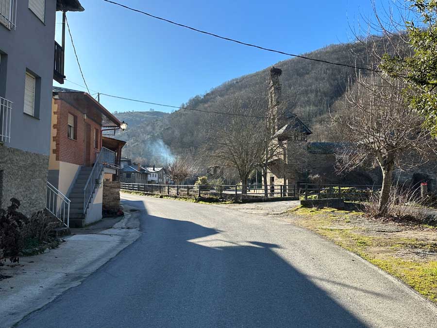

🥾 Ponferrada to Valdefrancos | Distance: 6.3 Miles / 10.1 Km | Duration: +/- 2 hours
Valdefrancos Village to Herrería de Montes Split
Valdefrancos village has no services, but there is a water fountain next to the church. The church has a few benches, which makes a nice place to rest. The village is famous for its ancient bridge over the Oza River.
To hit the next section of the trail, follow along the river and the abandoned church in ruins. Here, pick up a trail marked with a worn wooden signboard. It’s a fantastic trail through the forest that runs above the river. There will be a signboard marking a split in the trail. Follow the signboards across the stream to San Clemente.
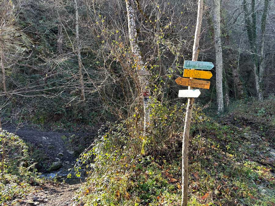
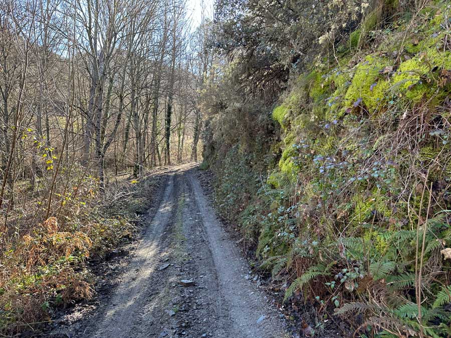

Follow the forest path until it merges again with the LE-5238 right before the village of San Clemente de Valdueza.
🥾 Valdefrancos to San Clemente | Distance: 1.5 Miles / 2.4 Km | Duration: +/- 40 minutes
San Clemente de Valdueza has no services, but it is a lovely village built along the Rio Oza. There is a water fountain in front of the church. Continue past the church to follow the road where you can see a signboard marking the Montes Aquilianos.
There’s a small trail section that goes past a secluded water fountain. The water fountain is labeled Fuente Frida and has a poem plaque. This is the last chance for water until Peñalba de Santiago.
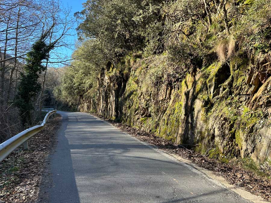
The fountain path again meets the main road. This section is quite narrow, so be mindful of traffic, although I never saw any cars driving. Along the road, you’ll pass by an old mill (to the left). I continued on the road past a large water plant. Keep going until you see a small fenced-off water station. If you continue to the hillside Ruinas de la Herrería de Montes, you’ve gone too far.
⁉️ Be mindful that at the Ruins you can alternatively follow the the PR LE 14 trail to Montes de Valdueza. It is marked with the official signboard that climbs the hill
If looking to continue to Peñalba de Santiago, you must cross over the Oza River at the small water station. There is a gate, but the door opens. Cross the bridge where you can see the first signage of the PR LE 14 Trail.
The PR LE 14 trail is part of a larger loop trail that connects Herrería de Montes, Peñalba de Santiago, and Montes de Valdueza. The trail is known as the Tebaida Berciana or the Tebaida Leonesa. The trail is well-marked with signboards and yellow and white blazes.
🥾 San Clemente to Herrería | Distance: 1.75 Miles / 2.8 Km | Duration: +/- 1 hour
Herrería Water Station to Peñalba de Santiago
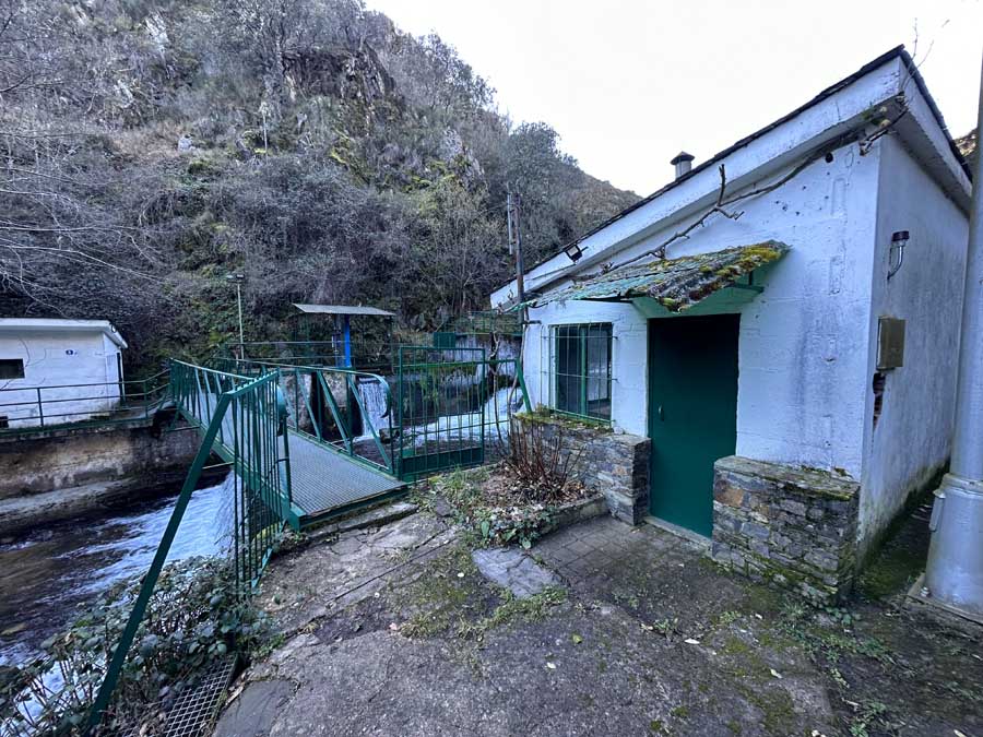
Cross the water station over the Rio Oza and continue to follow the yellow and white signboard to Peñalba. The official signboard says 2 hours and 45 minutes to Peñalba. I must have been running on happy adrenaline because it took me under 2 hours.
This was my favorite section of Stage 1 because it twists through the mountains. Some sections are through the forest, while others are exposed and offer incredible panoramic views.
It’s a fairly steep climb, and some of the trail is exposed stones. This would be extremely slippery in rainy or snowy conditions. Some trail sections can be narrow.
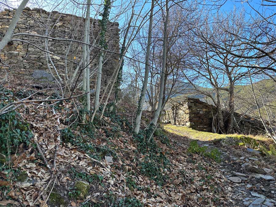
A notable point of interest is the Casas de San Mateo, small houses left in ruins.
The trail eventually leads to the road, where you follow it into Peñalba de Santiago. I opted to take the lower trail into the village rather than stay on the road.
🥾 Stage 1 | Ponferrada to Peñalba de Santiago | Distance: 12.75 Miles / 20.5 Km | Duration: at least 5 hours

Peñalba de Santiago (End Stage 1)
Peñalba de Santiago is officially registered on the list of Los Pueblos Mas Bonitos en España (Beautiful villages in Spain). The village is nestled in the Valle del Silencio at around 3,600 ft (1,100 m).
The tiny pueblo is famous for its stone homes that boast wooden terraces, slate roofs, and chimneys. The highlight of the village is the Mozarabic-style chapel that dates back to the 10th century. The special chapel alone is worth the Camino detour.
Don’t miss a chance to eat at La Cantina with its fabulous outdoor terrace with views of the Aquilianos Mountains. There’s also an old water fountain with a spectacular observation deck.

One of the best things to do in Peñalba de Santiago is simply wander the charming streets and soak in the energy of this peaceful valley.
With more time here, there are trails to waterfalls, old mills, and challenging mountain peaks to climb. As this can be a common day trip from Ponferrada, I think the best time to savor the silence of the village is in the evening and early mornings.
Where to Stay in Peñalba de Santiago
There are limited places to stay in Peñalba de Santiago. Those pilgrims walking the Camino de Santiago can make use of the small Albergue. As the mountain trails are known for spirituality, it may be possible to stay in the Albergue without a credencial.
➤ Make sure to verify your lodging before hiking to Peñalba de Santiago, as services can be limited.
I arranged my accommodation through La Cantina. They have a homey guesthouse that includes breakfast. There is a single room and a double room that offer a terrace. Breakfast is simple, but appreciated.
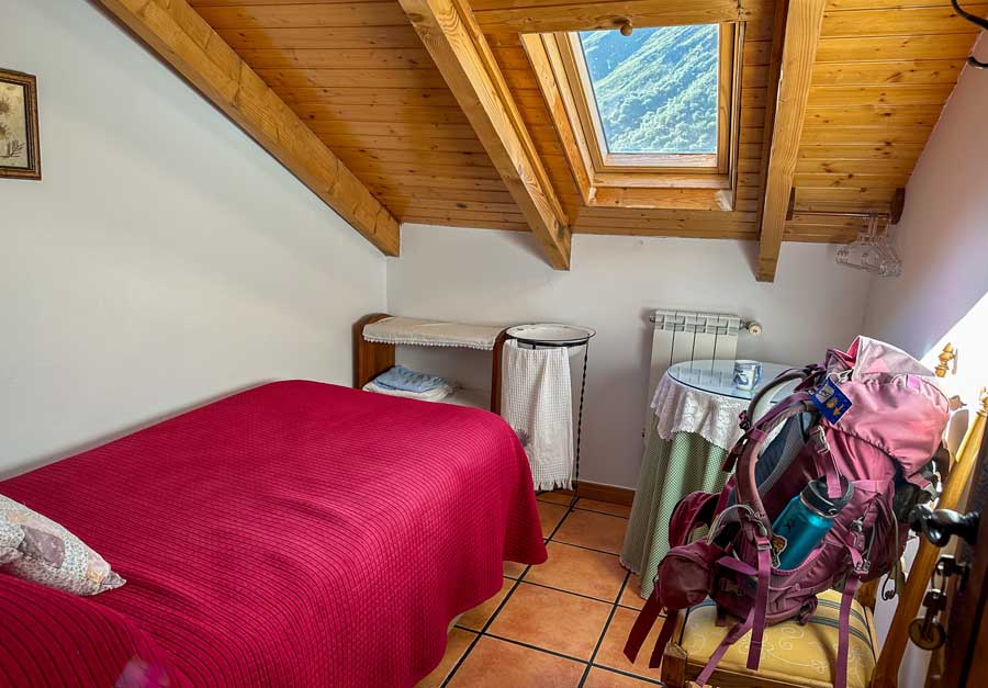
There are a few apartments available to rent in Peñalba de Santiago. Often these rentals require more than one night’s stay and are quite expensive for pilgrims.
- La Cantina Restaurant offers a single or double room (+34 987 620 201)
- Albergue Peñalba de Santiago (+34 686 163 424)
- Fogar Mozárabe
- Casa Turpesa
Day 2 | Peñalba to Montes de Valdueza (First Half Stage 2)
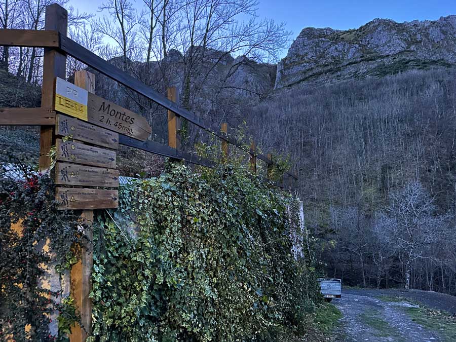
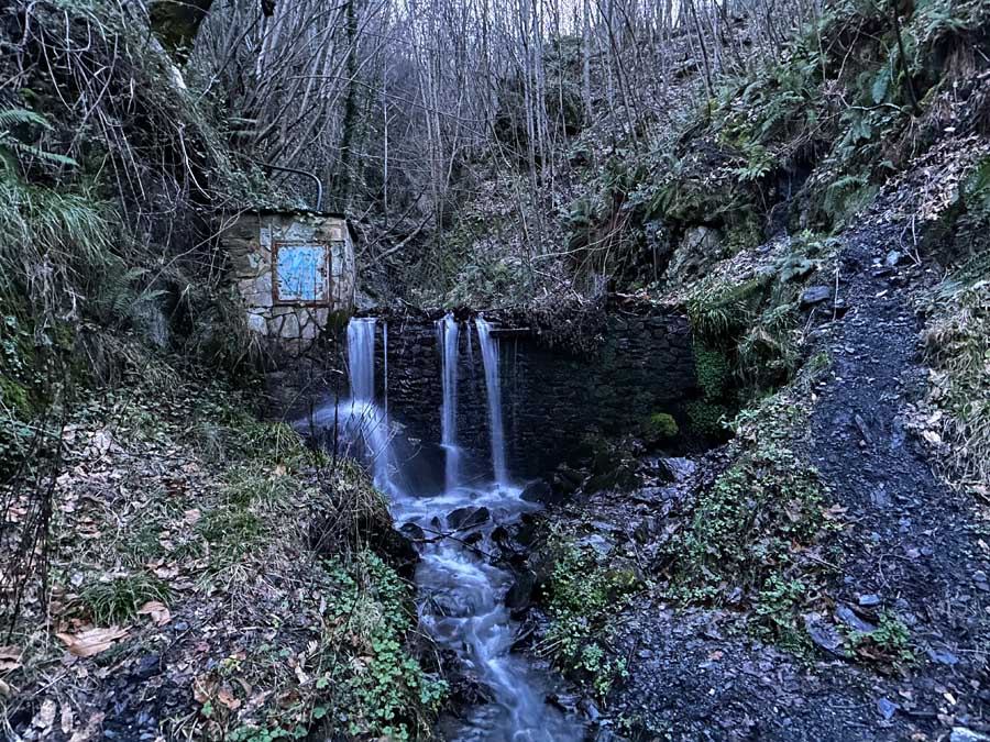
After a quiet night’s sleep, depart Peñalba de Santiago towards Montes de Valdueza. Remember, it’s best to plan on sleeping in Montes, especially if you want to detour to the cave and waterfall and explore the historic monastery in Montes.
The following day, depart from Peñalba de Santiago and head out of town by following the sign markers. The official signboard says it’s 2 hours and 45 minutes to Montes.
The trail will pass by the cemetery with the yellow and white signboards to Montes de Valdueza.
I opted to take the out-and-back trail section to see the Cueva de San Genadio. These caves and areas are famous for being the home to monastery communities and reclusive settlements since the 7th century. This was said to be the hermitage spot of San Genadio, a monk who was responsible for founding several monasteries in the El Bierzo region and spreading his love for Mozarabic art.
It is believed that the Valle del Silencio was named by San Genadio, who could not focus on his meditation in the cave due to the sound of the rushing river. He yelled “silence,” and the river obliged. Of course, there are numerous legends and myths as these lands have a rich, yet mostly unknown history.
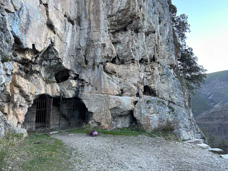
The cave detour as an out-and-back trail will add around a mile.
While the cave was nothing incredible, the views looking out on Peñalba were fantastic. There was also a signboard marking a trail to a waterfall, but, worried about my time, I missed this!
After visiting the cave, head back to the signboard and continue on the PR LE 14.
The path continues to a trail split that offers a high mountain trail (Montes Por Collado) or a lower path that follows the old Roman water canals (Canal Romano). These old Roman canals were used to collect water for the famous gold mine of Las Médulas.
If the weather is good and you feel comfortable, the high mountain route is definitely worth it. Alternatively, the old Roman canal is longer but not as intense. This is a good map that follows the Roman canal alternative.
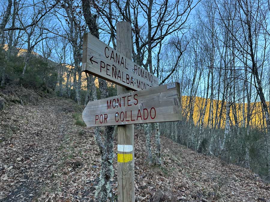


The Montes Por Collado gradually climbs up the mountains with unbelievable views of Peñalba de Santiago. This part is exposed, but there are epic views of the rocky mountain face to the left and the valley to the right. The mountain pass sits at 4,273 ft (1,302 m).
🥾 Peñalba de Santiago to Mountain Pass (High Route) | Distance: 3.25 Miles / 5 Km / Includes cave visit | Duration: +/- 2 hours
Follow the trail to begin a steep descent. This trail section is tough as it’s exposed and there are limited trail markers. There are loose rocks, but those first glimpses of Monte de Valdueza are one of the biggest rewards.
The trail continues, and you’ll see where the Roman canals route merges back together. Shortly after that, the next section is challenging with a warning sign. The trail is narrow and has exposed stones. It also has a stream to ford via stones. Be mindful of your footing while crossing the section.
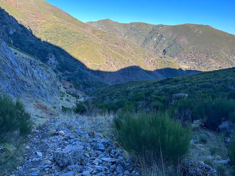
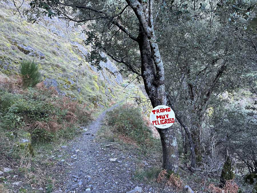

The way leads to Montes de Valdueza, a small village with lots of history.
I recommend sleeping here to break up the long stage to Villavieja. It also provides ample time to explore the village.
🥾 Stage 2 | Peñalba de Santiago to Montes de Valdueza | Distance: 5.25 Miles / 8.5 Km | Duration: at least 3 hours
Montes de Valdueza (Sleep Here to Break up Stage 2)
One of the main highlights of Montes de Valdueza is the Monasterio de San Pedro de Montes. This monastery dates back to the 7th century. The front church facade is from the 18th century.
Today, it houses an Albergue, and the monastery can be visited. Unfortunately, I passed in the offseason, and it was closed.
There is a water fountain near the church in Monte de Valdueza.
There is one small cafe in Monte de Valdueza, La Cantina de Sara.
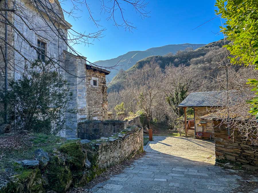
One thing I missed was the hilltop Ermita de Santa Cruz. The old stone chapel offers views of the mountains and village.
Make sure to verify if the Albergue and the restaurant are open. The Albergue shuts down during the winter, and when I passed through Montes de Valdueza, the Cantina was also shut.
If sleeping in Montes de Valdueza, you must carry enough food as there is no grocery store. The Albergue in Montes de Valdueza has a kitchen.
- La Cantina Sara in Montes de Valdueza (+34 987 695 194 )
- Albergue Monastery of San Pedro de Montes (+34 619 077 982 / Facebook )
⁉️ Remember, Days 2 & 3 can be walked in 1 day, but it is exhausting. The total distance is 17.75 miles (28.5 Km) with lots of ascents and descents in the mountains. I walked Stages 2 in one day, but it took me 8 hours with no rest.
Day 3 | Montes del Valdueza to Villavieja (Final Part of Stage 2)
The stage from Montes de Valdueza to Villavieja is tough. That’s why I think it’s best to break this stage over 2 days (Day 3).
Montes del Valdueza to El Collado
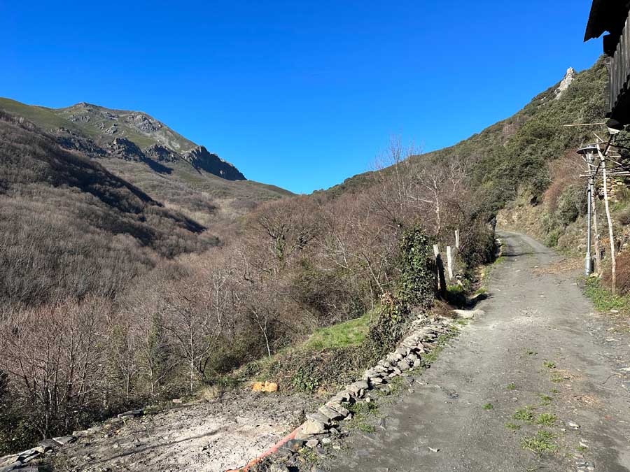
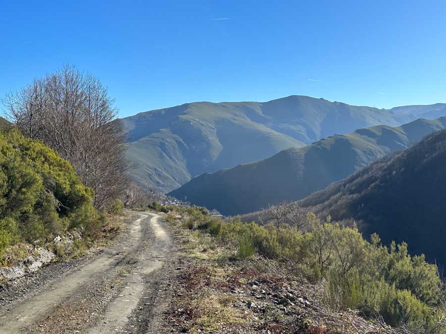
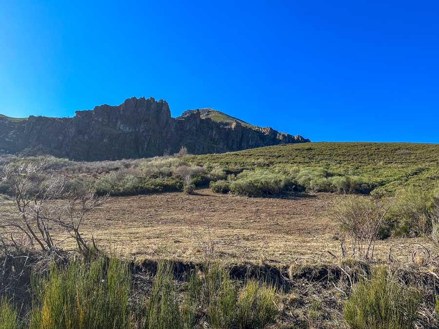
It’s a straight climb out of the village towards the Montes Aquilanos. Be mindful that there are lots of cattle in this area, with the possibility of mastiff dogs guarding them. I didn’t have any trouble with cattle dogs.
This trail section is exposed with no shade coverage and minimal (almost no) trail markings.
The trail leads to an open mountain saddle named El Collado. To the left are the impressive views of the mountain face called “The 12 Apostles.” The pass sits at around 4,422 ft (1348 m). There are lots of trails around this section, so make sure to check in with an offline map.
🥾 Montes de Valdueza to El Collado | Distance: 2 very steep miles / 3.25 Km | Duration: +/- 1.5 hours
El Collado to Campo de las Danzas

I followed a wide gravel trail to the right that seemed lower and maybe less direct. There was lots of fire and/or logging damage in this area, so this seemed like the best route option. This trail was flatter than the other and soon merged with a local paved road.
This is the LE-5204 road (Google Maps marks it as LE 158/4). Head to the left in the direction of Campo de las Danzas.
The road is steep and leads to a large open parking area with lots of trails. There is a stone marking Campo de las Danzas. Numerous hiking trails diverge from this area.
🥾 El Collado to Campo de las Danzas | Distance: 3.75 miles / 6 Km | Duration: +/- 1 hour
As you can see on my map, I followed a trail that was so severely damaged that it was closed (I also saw a wolf here). The trail was in such despair that I had to turn around and regroup. I lost some time and added some unnecessary miles.
Campo de las Danzas to Ferradillo
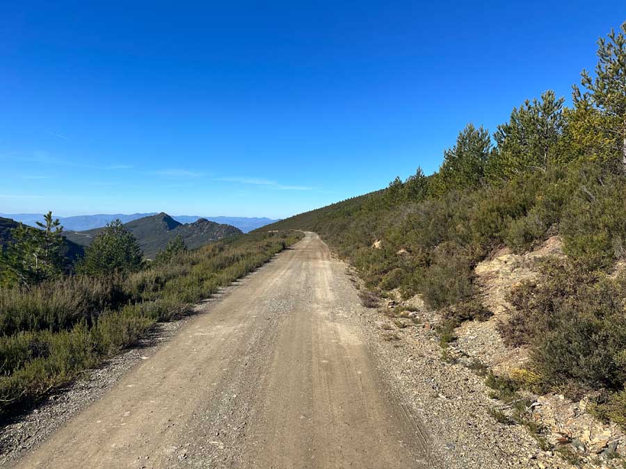
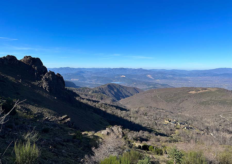
I returned to the main area of Campo de las Danzas and rerouted to a different path. I followed a trail to the left, which much better trail option. This route was also stunning and one of the highest points of my trek (4,921 ft/ 1,500 m).
I think it’s also possible to follow the right trail as it will lead directly to the Peña de Ferradillo.
As I followed the left trail, I had to turn to the right and walk alongside the unique mountains of Peña de Ferradillo to get my first distant views of Ferradillo. The gravel road continues, but look for the sharp left turn down the steep hillside. It is unmarked, but this trail leads down to the fountain at the entrance of Ferradillo.
Ferradillo is an abandoned village that has recently been revitalized by the “Amigos de Ferradillo” association. Some of the stone houses have seen some attention, but the church remains in ruins. There is a working water fountain in the village. This village is said to have some of the best views of the Aquilianos Mountains and sits at an elevation of around 4,140 ft (1,262 m).
In Ferradillo, we’ve already left the stunning Oza Valley and find ourselves in the municipality of Priaranza del Bierzo.
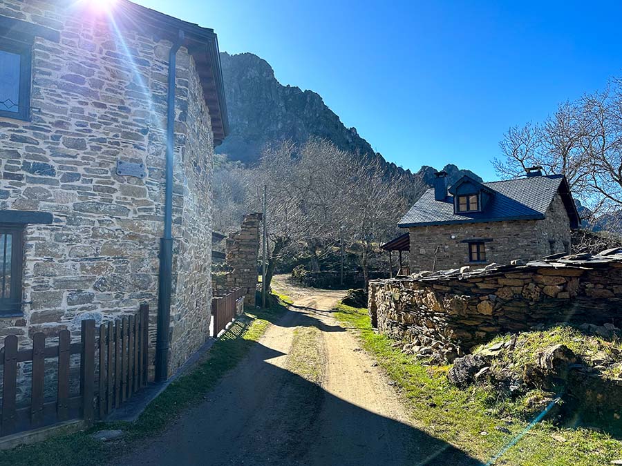
🥾 Campo de las Danzas to Ferradillo | Distance: 3.5 miles / 5.6 Km | Duration: +/- 1.5 hours
This village was used as a refuge by those fleeing the harsh rule of Franco. Many people who shared different views united in this region in the abandoned villages to fight Franco’s controversial regime, which is modernly labeled as a dictatorship.
Ferradillo to Villavieja via Ruta Peña del Hombre – Cornatel
Ferradillo is a great place to take a quick rest. The village is quiet and nestled under the mountains. Just past the church, join the official trail of the Ruta Peña del Hombre. This trail is marked with yellow and white blazes.
There are alternative route options, as the Ruta Peña del Hombre – Cornatel is a loop trail. If you have time, you could detour to the Castro de la Peña del Hombre, ruins that predate the Roman conquest. This would add a little over 4 miles as an out-and-back trail from Ferradillo. Plan for this to take at least 2 hours, more with exploring the Castro.
This is also why I wished I had broken this trek over 3 days, so I could have visited all the regional attractions!

However, as I was short on time, I walked along the forest trail that follows the stream. This is towards Cornatel, as the Cornatel Castle is found near Villavieja. This trail section can be muddy if there has been a lot of rain. It’s also a gradual ascent all the way to Villavieja.
The forest trail passes by an old water mill and boasts some spectacular scenery. Just be mindful that while there are trail markers, some sections may not be as apparent as others.
This trail leads to Villavieja, a village that is found on the Camino de Invierno, or the Winter Way. The Camino de Invierno leads pilgrims to Santiago de Compostela, the alleged resting place of Saint James.
The trail merges directly with the Camino route near the fountain of Saint James.
🥾 Montes de Valdueza to Villavieja | Distance: 12.5 Miles / 20 Km | Duration: +/- 5 hours
Villavieja (Ends Aquilianos Mountains Trek)
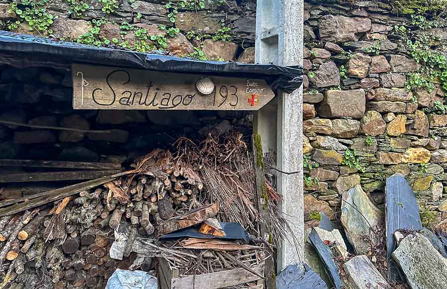
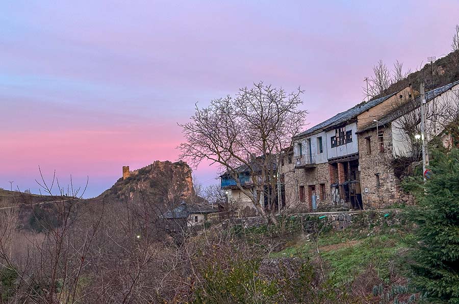
Villavieja is a popular stopping point on the Camino de Invierno. Some pilgrims sleep here as an alternative way to break up the first stage of the Camino de Invierno.
The village has no services but does offer a fantastic Albergue for pilgrims. Villavieja sits at a comfortable elevation of 2,505 ft (764 m).
As the village is small and quite isolated, make sure to have your accommodation option arranged in advance. Cell service in the town is nearly almost nonexistent and the Wi-Fi password at the Albergue is only available after check-in.
Again, it’s essential to carry enough food. The Albergue in Villavieja has a fully stocked kitchen.
- Municipal Albergue de Villavieja “Manuel Fuentes” / Contact: Mon – Fri from 9:00 – 14:00 (+34 987 420 806) / Evening, Weekends, Festivals 11:00 – 20:00 +34 606 898 140
Villavieja is the closest village to the Cornatel Castle, another historical castle that has ties to the Knights Templar. It’s possible to visit the Castle, but it’s best to verify their hours (+34 606 898 140) before visiting. The standard entrance fee to visit Castillo de Cornatel is €3.
After Villavieja, the next day of the Camino de Invierno continues to Borrenes with different route options to reach the unique landscape of Las Médulas. After this, Puente de Domingo Flórez is the last village in Leòn before entering the incredible region of Galicia.
How Much to Budget for Trekking in the Mountains near Ponferrada?

I walked this detour route on the Camino de Invierno during the offseason. Weather-wise, it was fabulous as it was an abnormally warm month. There was no snow in the mountains, no rain, and sunny skies with a cool breeze. Heaven.
Where I ran into problems was with limited accommodations and places to eat.
I spent the night in Ponferrada before my departure, which is not included in these expenses. I did stock up on groceries and purchased my credencial for the Camino de Invierno, which is included in my expenses.
| Expenses | Euro (€) |
| Groceries in Ponferrada | €13 |
| Accommodation Expenses (2 nights) | €60 |
| Cafes & Restaurants | €23 |
| Donations & Misc Expenses | €4 |
| Total (2 Days) | € 100 |
This two-day trek in the Oza Valley and Aquilianos Mountains cost me around 100 Euros. This is on the lower side, as it would be best to walk this route more comfortably over three days. I did sleep in a private room in Peñalba de Santiago, but sleeping at the Albergue in Peñalba would also help cut down on these expenses.
I wanted to sleep at the Montes at the Albergue, which has a nightly fee of €12. If this were the case, I would have also had to pack a little more food, which would increase my grocery expenses.
Additionally, I didn’t get to tour the Monastery in Montes de Valdueza or visit the Cornatel Castle, as they were both closed. Make sure to take some extra cash, as there are no ATMs on this route. I was able to charge my room and meal in Peñalba de Santiago through La Cantina. This was nice because they kept a “running tab.”
Conclusion | Hiking in the Oza Valley, Valle del Silencio & Aquilianos Mountains
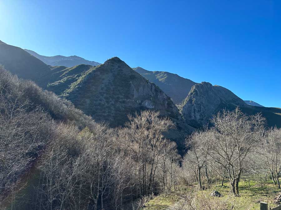
In short, this hiking guide provides an opportunity to explore the incredible Oza Valley, the underrated area of the Valle del Silencio, and the Aquilianos Mountains.
This multiday trek starts from Ponferrada, a medieval city that has connections to both the Camino Frances and the Camino de Invierno. These mountains are found in the El Bierzo region in León, Spain.
This mountain trek is a possible detour to the Camino de Invierno and passes through the untouched high mountains. Highlights of this trek include the villages of Peñalba de Santiago, Montes de Valdueza, Ferradillo, and Villavieja, where it merges with the Camino de Invierno.
This is an isolated route and is best suited for those in good physical condition who feel comfortable following an offline map in the high mountains. It is not a typical Camino de Santiago route.
Included in this hiking guide are my personal maps, useful tips, and a day by day itinerary.
Have you hiked in the underrated region of the Valle del Silencio and the Aquilianos Mountains near Ponferrada, Spain? What did you think? Are there any updates that I should know about? Let me know in the comments below.
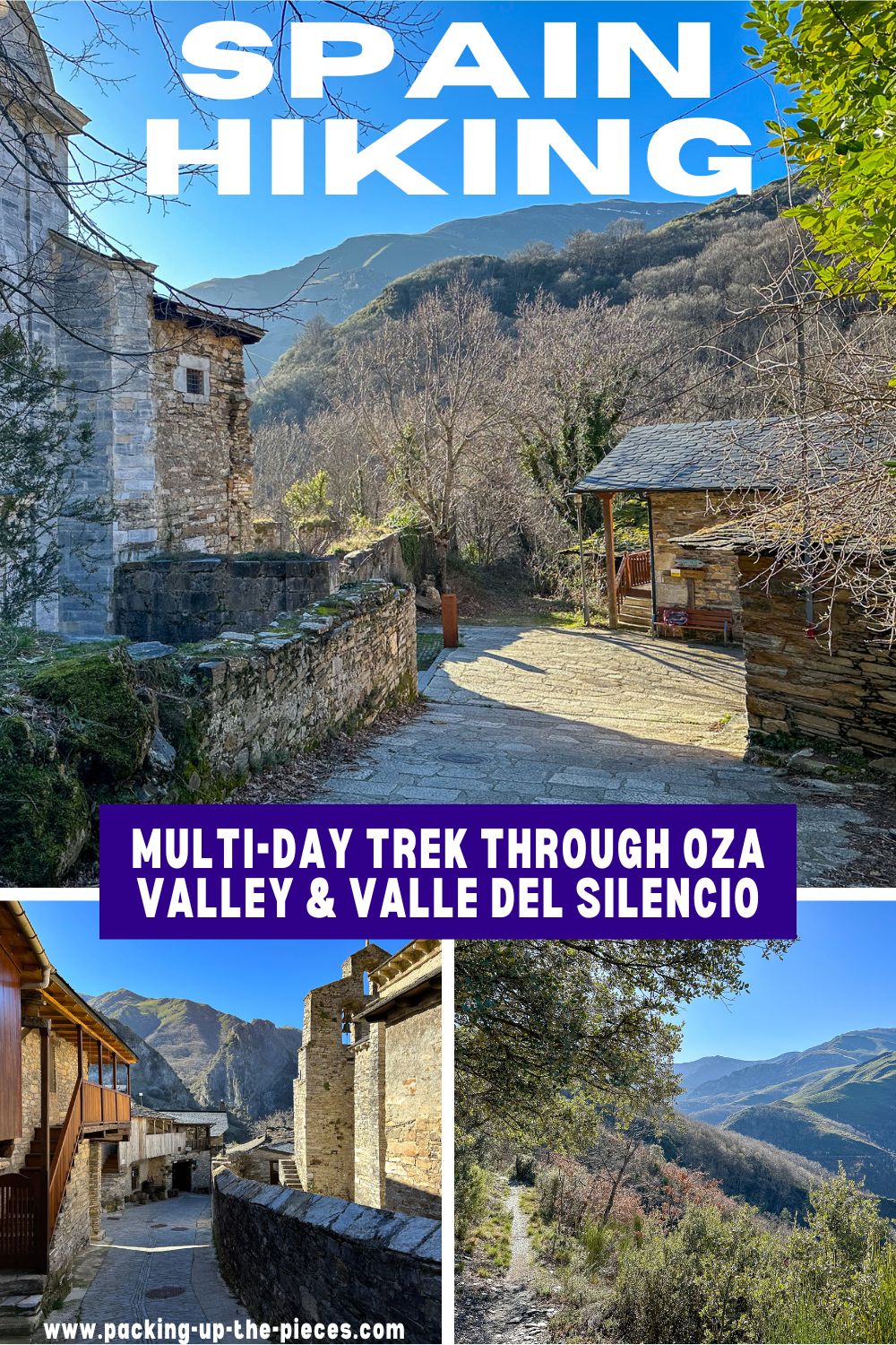
Pack This Post for Later! Pin It!
Disclaimer: There’s a chance this post contains affiliate links, and I receive a small (but grateful) portion of the sale. There’s no extra cost to you, and I only promote things that I use and love.