10 Epic Camino Frances Detours That Are Totally Worth It
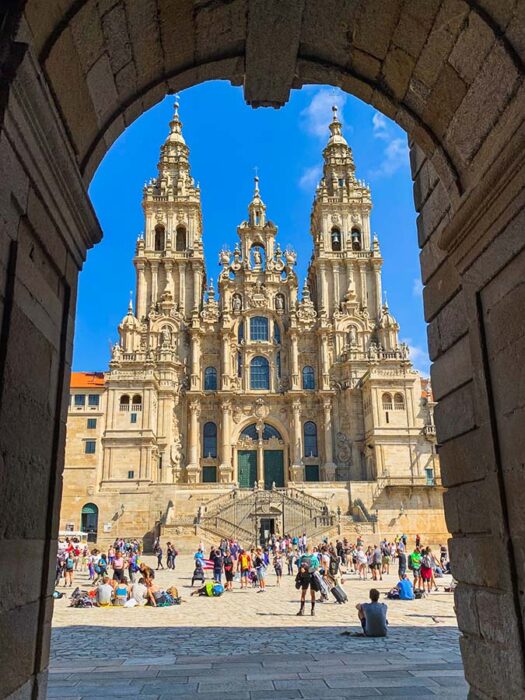
The Camino de Santiago is one of the most popular pilgrimage routes in the entire world. Pilgrims follow the yellow shell signboards for days, weeks, and months to reach the final destination of the stunning Cathedral in Santiago de Compostela, Spain.
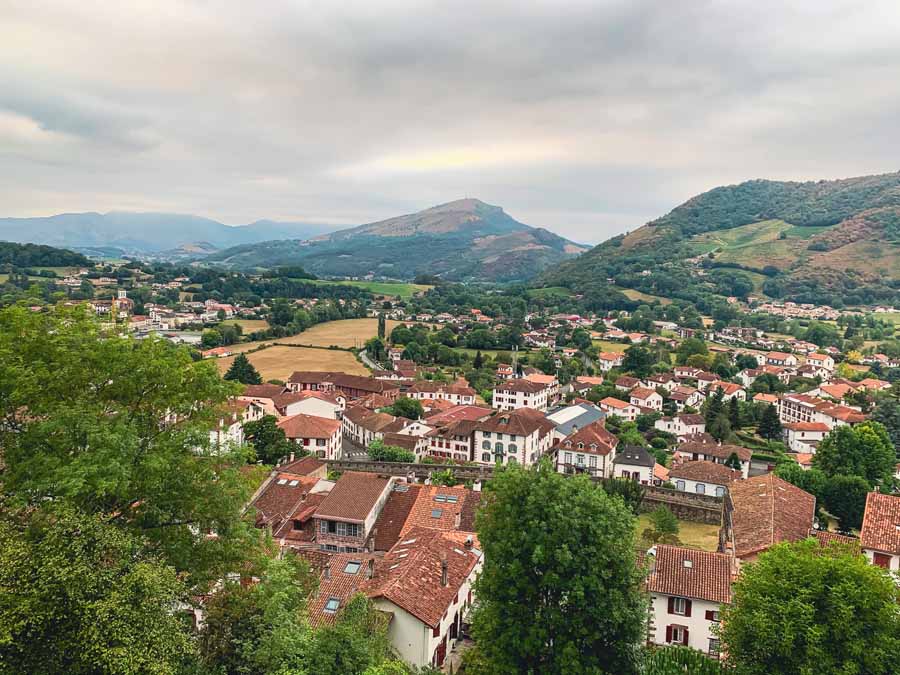
There are many diverse Camino routes, but by far the most trekked is the Camino Frances. The Camino Frances starts from Saint Jean Pied de Port in France, crosses over the Pyrenees Mountains, moves through the Basque region of Spain, and continues through beloved Spanish wine regions, historical cities, charming villages, and diverse landscapes.
The Camino Frances route, or the “Way of St. James,” is approximately 484 miles (779 Km) and takes an average of 33 days to complete. And while that may seem like an overwhelming amount of miles, there are so many Camino Frances detours, or worthwhile stopping points of interest to see along the way.
The best Camino Frances detours include tucked-away churches and monasteries, scenic trails, charming villages, unforgettable Albergues, and some seriously off-the-beaten hiking trails. Some of these Camino Frances detours are challenging and twist through the mountains, while others are just a few steps off the main route.
In general, all of these Camino Frances detours offer a quieter and more reflective time of walking, since few pilgrims take these alternative paths.
Here are 10 epic Camino Frances detours that are totally worth the effort!
Table of Contents
- Overview of My Personal Camino Frances Detours
- 10 Best Camino Frances Detours
- Bonus | Add-On the Camino Finisterre Muxia
- Conclusion | Best Camino Frances Detours
Overview of My Personal Camino Frances Detours
I walked the Camino Frances as a solo traveler and tacked on every one of the following Camino Frances detours. With the following detours along the French Way, I completed my Camino in 31 days. This was with no rest days and included all of the following Camino Frances detours.
While the standard Camino Frances distance is 484 miles, I walked in front of the Cathedral de Santiago de Compostela with just about 522 miles. All of these detours added about an extra 38 miles (61 km).
A majority of these Camino Frances detours simply run parallel to the main Camino Frances route. There is only one out-and-back trail on this list to the Carracedo Monastery, which I only mention since I did not visit.
Many of these routes are shown with detailed maps in John Brierley’s Camino Frances Guidebook, which I referenced when walking my own Camino.
One could say these Camino Frances detours are less commercialized, hence offering a more authentic and reflective experience. But again, there is no wrong way to walk the Camino. No matter what path you choose, it will change you.
Camino Frances Divergent Routes

It’s worth noting that this guide focuses on Camino Frances detours. If looking to completely divert from the Camino Frances, there are two great options.
➤The first is in León, where pilgrims can leave the Camino Frances and take the connector route of the Camino de San Salvador to Oviedo. In Oviedo, follow the first-ever Camino route, the Camino Primitivo. Be mindful that the Camino Primitivo does rejoin the Camino Frances in Melide.
➤The second route option comes in the medieval city of Ponferrada. From here, pilgrims can walk the quiet path of the Camino de Invierno. This route passes by Las Médulas, the breathtaking Ribeira Sacra, Monforte de Lemos, and the mystical Pico Sacro.
Camino de Santiago Apps & Online Resources

Here are some great online resources and Camino de Santiago Apps that come in handy when walking the Camino de Santiago.
- Gronze is a popular Spanish Camino website with tons of useful information for multiple Camino de Santiago routes.
- Join the Private Camino de Santiago 2025/2026 Facebook Group for the most up-to-date information. Make sure to check the search tab if you have specific questions.
- Camino Ninja App is a Free Camino App
- Wise Pilgrim (99¢) is another popular Camino App
- Booking.com is an excellent resource for securing private albergues, casas rurales, pensions, and accommodations along all of the Camino routes
- Maps.me is my go-to offline map and has all the paths for these Camino Frances detours
- I record all my routes with Wikiloc, and thousands of hikers have recorded daily Camino de Santiago routes.
- Google Translate is helpful for translating any language into Spanish.
- These are all my best recommended apps to download when walking the Camino de Santiago
10 Best Camino Frances Detours
These Camino Frances detours are in sequential order from St. Jean Pied de Port France to Santiago de Compostela Spain. Almost every detour I mentioned includes a map link.
Skip to | Luquin Village | Yuso & Suso Monastery (Camino Real) | Via Romana | Paramo Path | Castrillo de Polvazares | Castro Ventosa | Camino Dragonte | Samos Monastery | Castromaior Ruins
1 | Church of Saint Mary of Eunate

After the beautiful city of Pamplona and before Puente la Reina, the 12th-century Romanesque church of Eunate is an easy and worthwhile stopping point on the Camino Frances. The octagonal church’s origin story remains a mystery, but some suggest the church was built or linked to the Knights Templar.
This special church is an easy detour off the Camino Frances route. From the Plaza Mayor of Muruzabal village, follow the signboards to the church. The road follows along a gravel path past endless fields to the church.
The Eunate Church is small and lovely. The interior is simple, but there is a special energy here. Maybe that has to do with the original church’s name of Ehunate, which translates from Basque to “one hundred doors.” Is this curious place a gateway to another realm? No matter the origins, there is an alluring charm when visiting the Church of Saint Mary of Eunate.


Eunate Church | Location: Carretera de Campanas, Muruzábal, Navarra, Spain | Entrance Fee: €1.50 with the Pilgrim Credencial discount | Hours: Hours vary by season, but typically Daily: 9:30 – 14:00 & 15:30 – 19:00 / Closed January – March | Here’s the Official Website
After visiting the church, follow the road past the church to the village of Obanos.
🥾 This Camino Frances detour starts from the village of Muruzábal, stops at Eunate Church, and rejoins the Original Camino Frances route at Obanos | Total Distance: 3.1 miles (5 Km) | Duration: 1 – 2 hours with a visit to the Church | Difficulty: Easy
➜ This Wikiloc Map includes a walking path to Eunate Church
2 | Scenic Path to Luquín Village

After the popular city of Estella, with the famous Irache wine fountain, there is a spectacular detour to Luquín village. This long stretch of dirt trail is quite isolated and follows along the lower hillside of Monte Jurra.
The first part of the trail is wooded, so it’s shaded. The official signboard reads 16.5 Km to Los Arcos and 6.1 Km to Luquín, so be prepared for a long hike, especially if you don’t have a room reserved in Luquín.
The trail twists through the forest and eventually comes to an open trail. This trail leads to Luquín and offers incredible views of the original Camino Frances route of the village of Villamayor de Monjardin and the peak with the hilltop ruins.

Luquín has two lovely churches and boasts a busy and local municipal pool that is perfect for cooling off. The entrance fee to the pool is 6 Euros and makes for a nice place to stop on the Camino Frances if you snagged a room at Albergue Casa Tiago. There is an on-site restaurant at the pool as well.
➜ Luquín is a tiny village with only one private Albergue, Albergue Casa Tiago. To secure one of the 14 beds in the dorm, you’ll need a reservation.
If there is no room at the Inn, be prepared to walk 7.7 miles (12.4 Km) to Los Arcos with absolutely no shade coverage. It is not advised to walk this section in the afternoon sun. Trust me, I made this mistake. There is absolutely zero shade coverage after leaving Luquín.
The exposed dirt path meets the original Camino Frances route at La Cruce, right before the apparent ruins of an old pilgrim hospital. The path leads to Los Arcos, where there are plenty of places to stay. Los Arcos also has the Municipal Albergue Isaac Santiago with 70 beds, for a fee of €8 per person.
🥾 This Camino Frances detour starts after the Monasterio Irache stops at Luquín for a break or overnight and rejoins the Original Camino Frances route at Cruce, where it continues to Los Arocs | Total Distance Irache to Los Arcos: 11 miles (17.7 Km) | Duration: + 4.5 hours from the Monasterio Irache to Los Arcos | Difficulty: Moderate
Notes on the Scenic Path to Luquin

This day was super long, as I started from Cirauqui, which I do not recommend. I loved sleeping in Cirauqui, but walking all the way to Los Arcos was tough. Most pilgrims sleep in Estella and make their way to Los Arcos.
Make sure to have plenty of water and snacks, as there is nothing along the path. Avoid walking this section alone. There is no shade coverage, and during the summer, heat exhaustion is a real threat. We saw no pilgrims on the path to Luquín the entire day.
Make the reservation to sleep in Luquín well in advance!
There is a water fountain in the main plaza of Luquin, so fill up before continuing to Los Arcos. This is the last water source until Los Arcos.
➜ This Wikiloc Map includes the detour to Luquin village
3 | Camino Real to Monasteries of Yuso & Suso in San Millán de la Cogolla


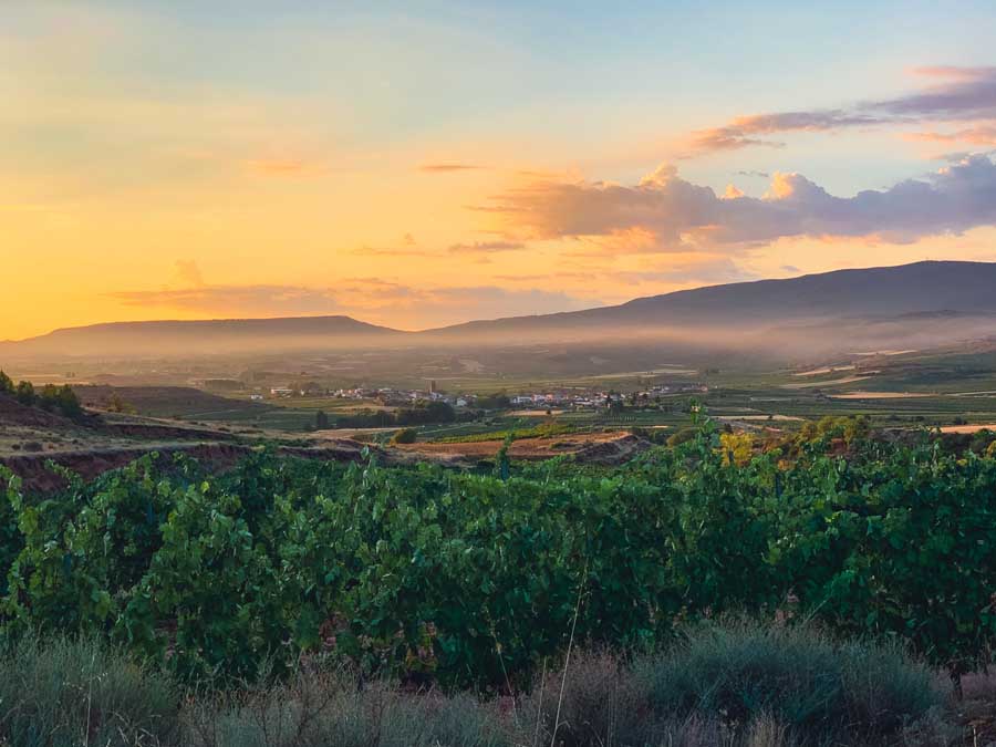
One of the best Camino Frances detours is to visit the UNESCO World Heritage Site of the Monasteries of Yuso & Suso in San Millán de la Cogolla. This is one place you don’t want to miss on the Camino Frances!
From the village of Nájera, it’s possible to walk to San Millan de la Cogolla. The route follows the Camino Real, which starts from the Plaza Mercado Nájera and scrambles alongside the dramatic red cliffs. Be mindful of rockslides and muddy trails. This hike should not be attempted in poor weather conditions.
From there, the trail continues on a dirt path through vineyards with the distinct red soil of the “La Rioja” region. There are two main routes, but we preferred the views and tranquility of the trails through the heart of the vineyards rather than the one that leads to Cordovin village. Either trail is fine!


The path leads to Badarán village, a village that has a special feel. At the end of town, look for the wooden sign on the left side of the road that reads “Camino Real, Vado de la Reina.” The trail comes to the river, where you cross a bridge. Again, two trails lead to San Millan, but we opted for the “river trail.”
Both trails meet at the village of San Millan de la Cogolla.
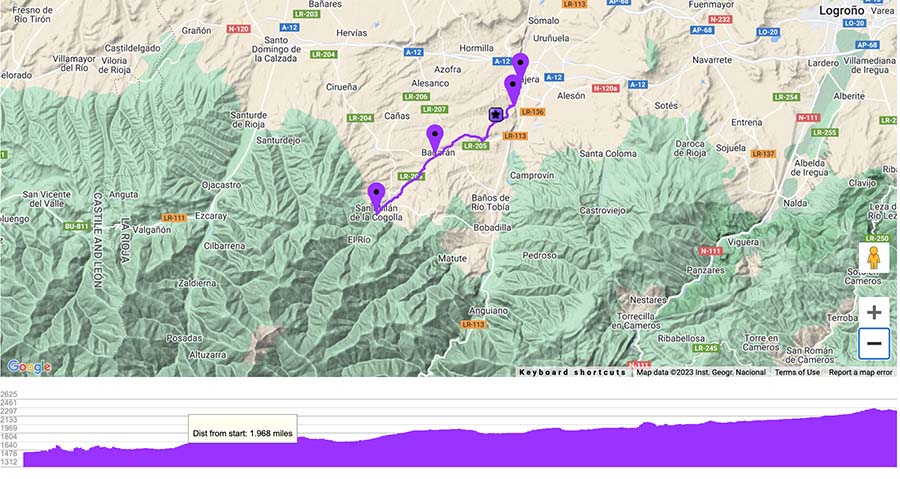
🥾 This Camino Frances detour starts from Najera and visits the Monasteries |Rejointhe Original Camino Frances route back to Najera by taking a bus or walking to the village of Cirueña | Total Distance Najera to San Millan: 11.25 miles (18 Km) | Duration: +/- 4 hours to walk and then a few hours to enjoy both Monasteries | Difficulty: Moderate
Don’t feel comfortable walking the Camino Real to San Millán?
The trail can seem intimidating, and few pilgrims take this incredible route! There is a local bus that connects Najera to San Millán de la Cogolla. All the bus times are posted outside the local Tourist Office in Najera.
The bus route is Logroño – Estollo and costs around 2 Euros for a one-way ticket. Make sure to verify the times back to Najera.
How to Rejoin the Camino Frances

There are multiple ways to rejoin the Camino Frances after visiting the Yuso and Suso Monasteries.
✔ Take the afternoon bus back to Najera, sleep in Najera, and continue on the official Camino Frances the following day.
✔ Sleep in San Millán de la Cogolla at one of the nearby lovely guesthouses and walk the next day back to Najera. Casa Rural La Calera is a great option just on the outskirts of the village. For a real treat, sleep at the actual monastery, Hostería del Monasterio de San Millan. The following day, you could also rejoin the Camino Frances in the direction of Cirueña.
✔ In the afternoon, continue to Cirueña. Be mindful that this trail is unmarked, but combines a mixture of trails and main traffic roads. The trail from San Millán de la Cogolla to Cirueña is an additional 8.25 miles (13.25 km) and takes around 3 hours. Sleep in Cirueña.
4 | Roman Road via Calzadilla de los Hermanillos


Pilgrims can choose to walk a section of the Old Roman Road just after the interesting town of Sahagún. Today, the Roman Road is just a dirt path, but it offers a more isolated and alternative route on the Camino Frances.
The Via Romana path runs parallel to the main Camino Frances route.
A little more than a mile after Sahagún, veer right towards the village of Calzada del Coto. The trail is clearly marked as the Via Romana. Before setting out, there is one last chance to rejoin the original Camino Frances route.
The trail continues to Calzadilla de los Hermanillos, which has a simple Municipal Albergue, a few guesthouses, and restaurants. The village makes an excellent place to spend the night before continuing on the long and desolate Roman road to Mansilla de las Mulas.
🥾 This Camino Frances detour starts from Calzada de las Hermanas via Calzadilla de los Hermanillos and rejoins the Original Camino Frances route back at Mansilla de las Mulas | Total Distance: +/- 21 miles (34 Km) | Duration: Best broken up over two days with an overnight in Calzadilla de los Hermanillos | Difficulty: Easy, but long
Tips on Walking the Roman Road Camino Frances Detour
It’s best to walk the Via Romana over two days.
Sahagún is a really popular town to sleep in before the detour on the Via Romana. In Sahagún, you will find plenty of albergues and places to stay, cafes and restaurants, and beautiful streets and plazas. Sahagún is also the city that offers the official“Half-Way Certificate.”
I opted to sleep in the cute village of Moratinos before Sahagun. Albergue de Peregrinos Hospital San Bruno is one of the best albergues I’ve stayed at on the French Way. The quiet village has a restaurant and a chance to walk by the unique wine cellars built into the hillside. Sleeping here helped break up the two-day journey to Mansilla de las Mulas more evenly.
The Roman Road has no shade coverage, and besides Calzadilla de los Hermanillos, no villages. Avoid walking in the afternoon heat and make sure to carry plenty of water and snacks.
➜ This route shows is from Moratinos to Calzadilla de los Hermanillos
Calzadilla de los Hermanillos
Calzadilla de los Hermanillos is a nice village and is not nearly as busy as the main Camino Frances route. I stayed at the Albergue Municipal, which is donativo (by donation). I shared the entire spacious dorm room with one other person, so yeah, this route is a chance to do some serious contemplation.
La Calleja de Urbano is more of an expensive restaurant but has a cool atmosphere.
On Day 2 of the Via Romana, the trail from Calzadilla de los Hermanillos to Mansilla de las Mulas is about 14.5 miles (23.3 km) and takes around 4 hours.
➜ Here’s the route from Calzadilla de los Hermanillos to Mansilla de las Mulas
5 | Paramo Path After Leon to Hospital de Orbigo

León is a beautiful historical city with the unmissable Catedral de León with spectacular stained-glass windows. There’s also the worthwhile Basílica de San Isidoro with the enchanting Romanesque-painted chapel, Panteon Real. Don’t forget the Casa Botines, designed by Gaudí himself. In the summer and fall, stock up on fresh supplies at the bustling market in Plaza Mayor.
When leaving Leon, stop by and contemplate the Peregrino statue in the Plaza San Marco.
Yes, Leon is spectacular; however, one of the best Camino Frances detours comes not too far after León. Walk the tranquil paramo path that passes by incredible landscapes and adorable pueblos.
Leaving Leon isn’t so pleasant, as the way goes through a heavy industrial section. Just after La Virgen del Camino and the Fuente El Cañin statue, take the detour to the left. If you walk to the cemetery, you’ve gone too far.
➜ This route is for the Camino detour to Oncina de la Valdoncina from Leon


The trail continues through the small villages of Fresno del Camino, Oncina de la Valdoncina, Villar de Mazarife, and Villavante, where it reconnects with the Camino Frances at Hospital de Orbigo.
The dirt paths cut through endless fields of corn and the unique landscape that is the paramo. The sunsets and sunrises are truly stellar. Relax your feet at the amazing area de descanso, or resting point, between Chozas de Abajo and Villar de Mazarife.
🥾 This Camino Frances detour starts just after La Virgen del Camino and rejoins the Original Camino Frances route at Hospital de Orbigo | Total Distance: +/- 17.5 miles (28 Km) | Duration: Best broken up over two days with an overnight in Oncina de la Valdoncina | Difficulty: Easy – Moderate
Sleep in Oncina de la Valdoncina

Oncina de la Valdoncina has another one of my favorite albergues on the Camino Frances, Albergue El Pajar de Oncina. El Pajar is the place where hay for animals is stored. The friendly owner has converted the old stables into an inviting albergue with a huge garden, hammocks, moving artwork created by local artists, and a spectacular dining room where you can join in on the communal dinner (€13).
The owner is also in a band, so he loves playing music after dinner.
Oncina has another family-run guesthouse, Domus Oncinae, which is a little more upscale but has private rooms.
Oncina is a few simple roads with one church, but there is something really special about this place.
➜ Day 2 from Oncina de la Valdoncina to Hospital de Orbigo
6 | Castrillo de Polvazares


Castrillo de Polvazares is a cute village close to Astorga that is part of the La Maragatería region of Spain. This region is made up of around 40 villages in the mountains and includes Astorga. The region is home to the mysterious Maragatos culture. This ethnic group created villages using distinctive stone-building techniques and has its own cuisine, traditions, and colorful clothing.
The Maragatos’ origins are unknown to this day.
Castrillo de Polvazares is a superb and preserved village to visit to appreciate the Maragatos building techniques and indulge in the cocido maragato, a typical stew dish made with meat and chickpeas. The pueblo is popular with day trippers but is definitely worth a quick meander.
Detouring to Castrillo de Polvazares is a super-easy detour, as it used to be part of the original Camino Frances route. From the town of Murias de Rechivaldo, head right and follow the path next to the road to Castrillo de Polvazares.
There was one Albergue in the village, Albergue De Peregrinos Municipal De Castrillo de Polvazares, but it is now permanently closed. There are a few lovely guesthouses to sleep in Castrillo de Polvazares.
Stay the night, or continue on the trail to rejoin the Camino Frances route right before the small village of Santa Catalina de Somoza.
🥾 This Camino Frances detour starts from Murias de Rechivaldo and rejoins the Official Camino Frances route before Santa Catalina de Somoza | Total Distance: +/- 2.6 miles (4 Km) | Duration: +/ – 1 hour walking time | Difficulty: Easy
➜ This map shows the detour to Castrillo de Polvazares
7 | Castro Ventosa Ruins

After the historical city of Ponferrada, the way leads to the Bierzo village of Cacabelos, an area known for its wine production. There are also two great detour options from Cacabelos.
The first detour option is to the lonely Monasterio Santa María de Carracedo, which was originally constructed in the 10th century. This detour is from the city of Cacabelos and is a 2-mile (4 Km) out-and-back path along the road. The monastery is under restoration, so the hours are limited.
Alternatively, there is another interesting detour from Cacabelos to the ancient hilltop ruins of Castro Ventosa. To reach the ruins, head towards the pueblo of Pieros. After Bodegas Godelia, take a left and follow the road uphill to the Castro Ventos ruins. The route is uphill, so it provides incredible views that also pass right next to the rolling hillside vineyards.
The Celtic ruins are from before Roman times. Today, there is only a small gate still standing. While the ruins themselves have been excavated and aren’t that interesting, what makes this detour worthwhile are the views.
There is a footpath encircling the Castro Ventosa ruins, so soak in the breathtaking views of Cacabelos and beyond.

The ruins are free to visit. If you’re lucky, a friendly woman can show you a few pamphlets of what the site was believed to look like. After a circle around the site, follow the path down in the direction of Valtuille de Abajo, a village with a handful of small vineyards. The women working also walked me to the trailhead because it is unmarked.
➜ Here’s a map that includes the Castro Ventosa detour
The sign markers for the way reappear in Valtuille de Abajo. Follow the shells to a nice rest area that indicates the merging onto the original Camino Frances route.
After that, it’s about an hour to Villafranca del Bierzo.
🥾 This Camino Frances detour starts from Pieros and rejoins the Official Camino Frances route before Villafranca del Bierzo at the Pilgrim rest stop | Total Distance: +/- 3.6 miles (5.8 Km) | Duration: 1 – 2 hours | Difficulty: Moderate
8 | Camino Dragonte Route


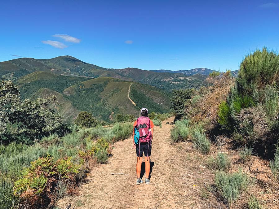
One of the best yet hardest Camino Frances detours is the Camino Dragonte route. Less than 1% of pilgrims attempt this intrepid hiking route that cuts through the breathtaking mountainside.
This challenging and full-day hike is remote and passes by tiny villages. Camino Dragonte has epic valley views and boasts magical forests lined with ancient chestnut trees.
There are few and far between signboards, but there are white and black posts that indicate the way. However, we relied a lot on an offline map and had help from local villagers. This is the trail less traveled, and some sections of the trail are overgrown, so the path is hard to follow.
The Camino Dragonte starts from Villafranca del Bierzo, so it’s best to sleep there the night before. Depart early in the morning and follow the main road up to Dragonte village. Make sure to stop in the unmanned mountain hut at Dragonte to check in with any updates, sign the guestbook, and stamp your pilgrim passport.

The trail includes the tiny hamlets of Moral de Valcarce, Villar de Corrales, San Flz do Seo, and Villasinde. Facilities are extremely limited, with a few water taps along the way. After Villasinde, the path will descend into the valley to Las Herrerías. After a long and excruciating day, it’s best to sleep in Las Herrerías and continue the next day into spectacular Galicia.
☛ Psst… I loved sleeping at Albergue Las Herrerías – Miriam
The Camino Dragonte is ideal for experienced hikers only, and those who are confident being in the mountains and utilizing off-line maps. As the weather in the mountains can change fast, it’s best not to attempt this route alone or in bad weather. Carry enough food and water for the day.
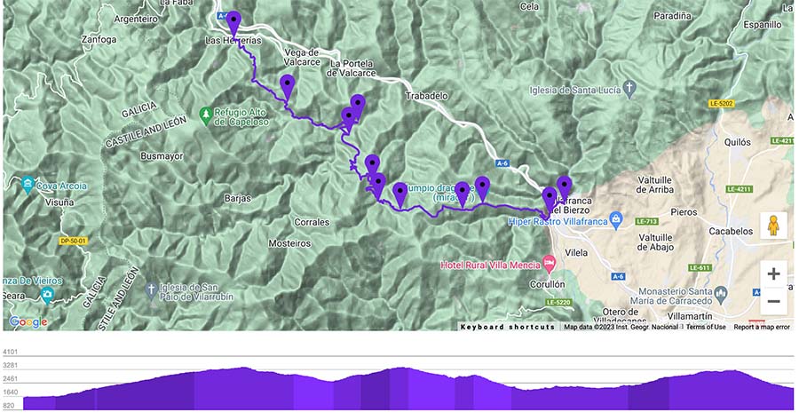
🥾 This Camino Frances detour starts from Villafranca del Bierzo and rejoins the Original Camino Frances route in Las Herrerías | Total Distance: +/- 17.8 miles (28.65 Km) | Duration: +/- 9 hours | | Difficulty: Challenging | The Camino Dragonte route is best for experienced hikers
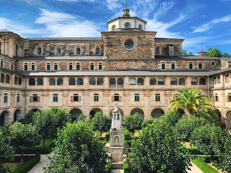
9 | Samos Monastery | Monasterio de Samos

One of the most popular Camino Frances detours is to Samos to see the Samos Monastery. The great thing about this detour is that it is clearly marked, and even the starting point has a waymarker.
The detour to Samos is best done as an overnight trip. The trail begins from Triacastela and leads to the village of Samos. It’s well-marked and offers stunning views of the countryside. You won’t forget those first glimpses of the Samos Monastery.
While the Samos Monastery was beautiful, I really loved the actual town of Samos. Samos was one of my favorite towns on the Camino de Santiago French Way.
In Samos, wander around town and take the circular route up to Capela do Ciprés, or the Chapel of the Cypress. The mighty tree stands over 88 feet tall and is believed to be at least 500 years old. There’s a legend that says if you rub the tree, it will help prevent blisters. I didn’t get another blister after visiting the tree!
The small chapel was built in the 9th century and is constructed in a Mozarabic style. The walking path is next to a peaceful river, which is the perfect place to relax, meditate, journal, or take a quick dip. The energy here is fantastic.

The Samos Monastery is the oldest inhabited monastery in Spain, with monks residing here for more than 1,500 years. The tour of the Samos Monastery is interesting, but only in Spanish and done by one of the resident monks.
There is a nightly pilgrim mass (Mon-Sat: 19:30). If planning on touring the monastery, it’s better to sleep in Samos village than continue farther.
There is an opportunity to sleep in the actual monastery at Albergue de Peregrinos del Monasterio de Samos. This albergue has 32 beds and is donation-based. Sweet volunteers run this no-frills albergue. The Monastery is also connected to the Hospedería Externa del Monasterio, which offers private rooms.
To rejoin the original Camino Frances route, follow the shells out of Samos, pass the town of Perros, go through a tunnel, and come to Hospital (Aguiada). The next “big town” is Sarria, where many pilgrims start their Camino, because it is the last 100 Km of the Camino Frances.
🥾 This Camino Frances detour starts from Triacastela and rejoins the Original Camino Frances route in Hospital | Total Distance: +/- 18.5 miles (30 Km) / Triacastela – Samos 12.25 miles & Samos – Hospital 6.25 miles | Duration: Best done over two days, with an overnight in Samos | Difficulty: Easy
Samos Monastery

The Samos Monastery must be visited on a guided tour. The pilgrim mass is free, but you’ll miss the most interesting parts of the building, like the beautiful courtyard and the fresco paintings.
Samos Monastery | Location: Abadía-Monasterio de Benedictinos, Av. Compostela, 16, 27620 Samos, Spain | Entrance Fee: €7, €5 with Pilgrim Credencial discount | Hours: Hours vary by season, but typically Mon – Sat tours run at 10, 11, 12, 16:30, with no tours on Tuesdays / Sundays at 12:45 & 16:30 | Must go on a guided tour that takes about 40 minutes | Check & verify the current visiting hours here
10 | Castromaior Ruins

Finally, do visit the Castromaior ruins. This incredibly preserved site is free to visit. Believe it or not, the ruins are only 150 meters off the main Camino route, yet so many pilgrims walk right past it!
Castromaior is believed to have been inhabited from the 4th century BC and makes an excellent pit stop to enjoy a picnic lunch.
The Castromaior ruins are marked with a purple signboard and are accessible right after Castromaior village.
Bonus | Add-On the Camino Finisterre Muxia

The Camino Finisterre Muxia is not a detour, but rather a spectacular route to add on to any Camino route.
The Camino Finisterre is the only route that actually departs from the Cathedral de Santiago de Compostela. This way is also referred to as the “End of the World,” since it finishes at the Atlantic Ocean. (The Romans believed Fisterra was the actual End of the World)
After walking for weeks, being landlocked, there is something truly special about gazing out into the vastness of the Sea.
The Camino Finisterre Muxia route sees fewer pilgrims, passes by picturesque villages, twists through the stunning green Galician landscapes, and finishes at either the village of Fisterra or the sleepy fishing village of Muxia.
Both ending points of the Camino Finisterre have a 0.0-kilometer marker and are located on the Costa da Morte (Death Coast), so choose the ending that feels right. If you have time, walk to both villages. They are equally special and both so different. This is my honest comparison of the Finisterre vs Muxia first debate.
The Camino Finisterre Muxia takes at least 3 days, and is around 55.5 miles (89.5 KM), but varies depending on which route you walk. If planning on walking to both Fisterra and Muxia, plan on 4-5 days of walking.
☛ Psst… If walking to Fisterra first, spend a night or two in Cee Spain where it’s possible to day trip to the lovely Cascada de Ezaro or climb up the sacred mountain of Monte Pindo, the fabled Mount Olympus of Spain
Conclusion | Best Camino Frances Detours

This is a list of my favorite Camino Frances detours. From secluded churches and ancient pathways to stunning monasteries, there is so much to see on the Camino Frances.
Hopefully, these Camino Frances detours are a great overview to see which places and sites pique your interest. With so much history and points of interest on every Camino route, it is impossible to do it all.
Besides, it’s just another excuse to start planning the next Camino, like most pilgrims end up doing, myself included!
Remember, the best way to walk the Camino is to walk it your way, just as in life. Don’t plan or overthink too much, simply let the magic and “way” unfold as you walk it.
While it’s nice to journey to all these incredible places along the way, the most epic destination is the internal journey of “coming home.”
Have you taken any of these Camino Frances detours? Which one was your favorite? Is there a stopping point you loved on the Camino Frances that isn’t included on this list? I’d love to hear about your journey in the comments below!
Pack This Post for Later! Pin It!


Disclaimer: There’s a chance this post contains affiliate links, and I receive a small (but grateful) portion of the sale. There’s no extra cost to you, and I only promote things that I use and love.


Hi, Megs
I enjoyed reading your detours. I have done most of them. I had to give up on the Dragonte as I got lost after Villar de Corralles.
Buen Camino!
Hey Albert-
Thanks for sending over all the edits. I went in and fixed a lot of them (yet I have to admit the ascents can be fickle on my keyboard).
I am glad you were able to safely return to Villafranca del Bierzo. The route was not extremely well-marked and I glanced at an offline map more than usual on the way.
I love the detours on the Camino routes! I just recently walked the Camino Portuguese from Porto and added a few along the way, too. 🙂
Buen Camino!
interesting site. I did 2 times the camino Frances, 1 time the camino Aragones and 1 time the via plata.
This time i would like to do the camino Aragones again but by MTB and do all the detours. To have also more time to enjoy the beautiful parts.
Are all these detours technically feasable to do by mountain bike or is there a lot of hiking with the bike to do ? Long hiking for me is to difficult
Hey-
Sorry for the delayed response. Some of these are only footpaths, and I am unsure about the local laws regarding mountain bikes on some of these trails. I know during the Dragonte route there are narrow arrows with stream crossing and wouldn’t be ideal for biking. Some would be easy to access on a bike, for example, Eunate Church and Samos Monastery, but I would check in with a designated app like Wikiloc, as I have only ever walked the Camino. I know there are oftentimes alternative and better paths for bikers.
I would love to do the Aragones route! I’ve heard amazing things! Buen Camino