
Ponferrada to Peñalba de Santiago Mountain Hike

- Created: April 2, 2024 4:01 pm
- Updated: April 10, 2024 12:35 am
- Distance Instructions
- Travel mode
- walking
- bicycling
- driving
- straight-line


- Distance 12 miles
- Time 5 h 0 min
- Speed 0.0 mph
- Min altitude 1660 ft
- Peak 3612 ft
- Climb 3366 ft
- Descent 1496 ft
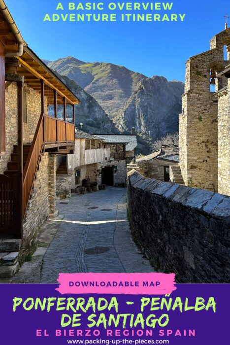
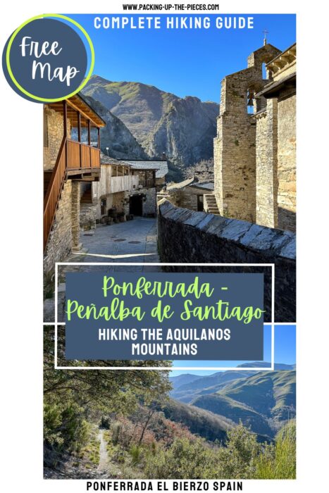
This is a quick overview of the hike to Peñalba de Santiago from Ponferrada Spain. This is a challenging hiking path that leads to the Valle del Silencio (Valley of Silence) and highlights the untouched beauty of the Aquilianos Mountains. Experienced hikers can walk from the medieval city of Ponferrada to arrive at the tiny mountain pueblo of Peñalba de Santiago.
I hiked this strenuous path as an alternative way to join the Camino de Invierno in Villavieja. This is day 1 of the two-day trek. In all honesty, it's best to hike it over 3 days due to the ascents and descents. I was fairly exhausted pushing myself to walk it over 2 days.
Recommended Route
| Day | Daily Stages | Distance | Duration |
| 1 | Ponferrada ➜ Peñalba de Santiago | 20.5 Km (12.75 miles) | 5+ Hours |
| 2 | Peñalba de Santiago ➜ Montes de Valdueza | 8.5 Km (5.25 miles) | 3+ Hours |
| 3 | Montes de Valdueza ➜ Villavieja via Ferradillo | 20 Km (12.5 miles) | 5+ Hours |
Be mindful this is not an official Camino de Invierno path and there are no Camino de Santiago markers or signage. This is not a typical route to "follow the shells," but rather it is a tough trail that takes experienced hikers through the mountains and one of Spain's most beautiful pueblos. I had to use an offline map and be mindful of signage for villages and mountain bikes.
While I have included signboards and markers, be mindful that markers may change. I noticed some paths that could have shortened my route, but I couldn't tell if some of the routes passed through private property. I opted to take the most obvious paths and trails that had markers.
The trail leaves Ponferrada via the Camino de Invierno, but detours after crossing the Boeza River and its medieval bridge.
Make sure to stock up on food and water as there are very limited services. In fact, there are no places to find food on the stages, but there are a few water fountains in some of the villages. Additionally, if rejoining the Camino de Invierno in Villavieja, you'll need at least two to three days of food. There are absolutely no food services in Villavieja, but the albergue does have a kitchen.
There are some restaurant options in Peñalba de Santiago, but it's best to verify that they are open, especially during the off-and-shoulder season. There are no supermarkets once you leave Ponferrada until artisan shops in Las Médulas (7.5 miles /12 Km after Villavieja).
The following days (or day) from Peñalba de Santiago to Montes de Valdueza to Villavieja are more challenging than the first. If looking to return to Ponferrada or continue to Villavija, make sure to have a taxi arranged before departing Ponferrada. The Tourist Information Center in Ponferrada has excellent resources and detailed maps.
This route is for those hikers who are in good physical shape, can read and understand an offline map, and is best for those who have experience hiking in the mountains. I would say this alternative hiking route is comparable to the Camino Dragonte an alternative detour on the Camino Frances, but harder as there is less signage, and takes two to three days to complete.
Here is my Ponferrada to Peñalba de Santiago hiking map.
⁉️ If downloading the Ponferrada to Peñalba de Santiago map, please verify that the map is correct and follows the waypoints. Oftentimes, there are daily updates to the site, map platforms, and other external issues that may cause a bug in downloading. Be mindful that this map is solely for entertainment purposes. See my full disclosure here. Always hike responsibly and respect the mountains by following a no-trace philosophy, avoid hiking alone, be conscious of the weather and personal limitations, and do not stray from the visible trail
Ponferrada to Peñalba de Santiago Hike Logistics
- Point to Point Trail
- Ponferrada to Peñalba de Santiago pueblo
- Official Trail Markers: The route does not have Camino de Santiago markers. It does offer limited signboards to villages. The trail out of Ponferrada is not marked at all. Before the Herria de Montes ruins, you'll need to cross the dam and join the official PR LE 14 to Peñalba de Santiago. This trail is somewhat marked with yellow and white blazes and is part of the Tebaida Berciana route.
- Difficulty: Moderate - Challenging
- Limited signboards and markers make this route challenging
- The trail is sometimes stoney and can be extremely slippery in the rain
- The PR LE 14 is a strenuous ascent through the mountains with a steep ascent into the village
- Distance Ponferrada to Peñalba de Santiago: 12.75 Miles (20.5 Km)
- Excursion Duration: At least 5 hours
- This trail is best to hike during the summer and shoulder seasons. Winter in the mountains can be extremely wet, and rainy, and the mountains are susceptible to snow coverage. Hiking in the high mountains is never a good idea during bad weather
- Essentials for Hiking to Peñalba de Santiago
- Offline Map from some source
- Extra Battery Pack for electric devices
- Water in a Reusable Water Bottle
- Trekking Poles if you love them
- Hiking Boots or trail runners
- Enough Food for 2 to 3 Days
- These are all items included in my Camino Packing List
Where to Stay in Peñalba de Santiago & Restaurants
As the villages are small, make sure to have your accommodation options arranged before departure. Peñalba de Santiago and Montes de Valdueza both have albergues open typically from April to October. In Montes de Valdueza there are no accommodation options during the winter months.
- La Cantina Restaurant offers a single or double room (+34 987 620 201 / Instagram )
- Albergue Peñalba de Santiago (+34 686 163 424)
- Aromas del Oza (+34 661 067 700)
Ponferrada to Peñalba de Santiago Hike
This is a basic overview of the Ponferrada to Peñalba de Santiago hike, a challenging alternative route for the Camino de Invierno. This map shows the main trail sections and villages for the first day of the hike. For the complete hiking guide, photo inspiration, and more detailed information, read the complementing blog post:
Mountain Hiking Route Oza Valley, Valle del Silencio, and Aquilianos Mountains
1. Camino de Invierno Signboard
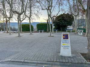
Leave Ponferrada towards the Camino de Invierno, but after you cross the bridge you'll head towards Peñalba de Santiago
2. Camino de Santiago Signboard
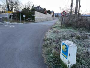
Points in the direction of Ponferrada for those pilgrims walking from El Acebo de San Miguel (French Way Detour)
3. Signboard
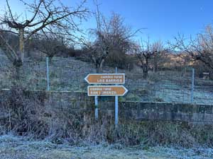
Signboard for Camino Rural Los Barrios or San Lorenzo (turn right)
4. Signboard Bike

5. Signboard
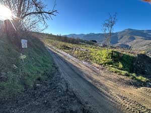
a sharp right turn to head towards the road to reach Valdefrancos
6. Valdefrancos
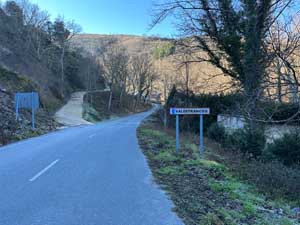
A small village with a church rest area, fountain, Roman Bridge, and NO SERVICES
7. Signboard

A wooden signboard (for direction San Clemente)
8. Sar Clemente Signboard

Before the River Crossing, look for a make-shift wooden signboard
9. San Clemente de Valdueza

a small village with NO SERVICES, small fountain below the church
10. Fuente Frida

Fountain with poem plaque
11. Molino de San Juan (Signboard)
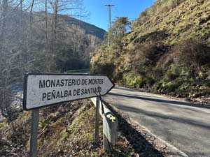
Signboard near old mill, follow the road to the water station
12. Water Source Station

Enter the Water Station through the gate fence and cross the bridge over the river to look for PR LE 14 Markers
13. PR LE 14 Signboard to Peñalba
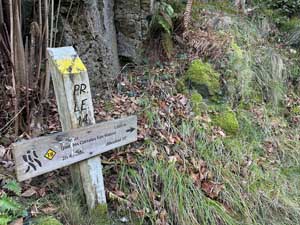
First Signboard to Peñalba de Santiago (route marked with yellow and white blazes of the Tebaida Berciana Route)
14. Ruins
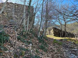
Casas de San Mateo ruins
15. Signboard near Road

Follow the road to Peñalba de Santiago
16. Lower Entrance Peñalba de Santiago

I took the lower entrance into Peñalba de Santiago